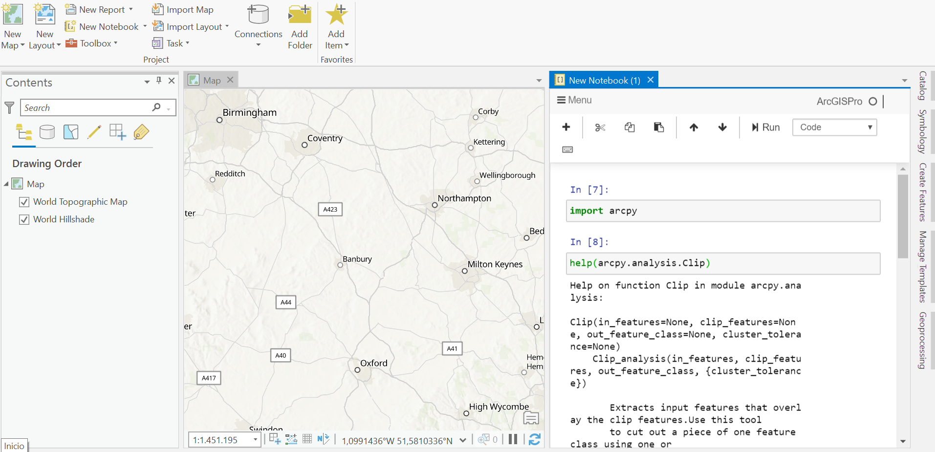
Since the release of ArcGIS Pro 2.5, a new feature called ArcGIS Notebooks is supported. The concepts behind this feature are discussed below.
What are ArcGIS Notebooks?
ArcGIS Notebooks are integrated Jupyter Notebooks inside of Pro. A Jupyter Notebook is an open-source web application that allows users to create and share documents that contain live code, equations, visualizations and narrative text. These are used widely in the data science community for sharing workflows containing annotated code cells using markup language, as well as the results of data science analysis in the form of graphs, tables and maps.
With ArcGIS Notebooks inside Pro, the latter application has been extended with open source Python packages plus an environment to create annotated Python scripts that can be saved and shared. ArcGIS Notebooks are built on top of Jupyter Notebooks, which means they do not offer all capabilities of the current Jupyter Notebooks. For example, ArcGIS Notebooks only support the Python language, whereas the Jupyter system supports over 100 different languages. ArcGIS Notebooks have item file extensions when shared or downloaded.
ArcGIS Notebooks are part of Projects
With ArcGIS Notebooks being available in Pro, you can now create your own notebooks for automating, modeling and scripting workflows and Python code. They are part of ArcGIS Pro projects, whereas Jupyter Notebooks exist independently. ArcGIS Notebooks form a central part of a GIS data science workflow, which is why you can dock the notebook pane within Pro’s interface.
ArcGIS Notebooks let you share workflows and code
The inclusion of Jupyter Notebooks inside Pro is good news for anyone looking to combine Python data science libraries with the functionality of Pro. If you’ve ever used the Python window, you can see ArcGIS Notebooks as an improved and extended version of that tool and use it to interact with your map. For example, you can run geoprocessing tools on your map data (and non-map data), after which the map is updated automatically with the results of that analysis.
The added value of ArcGIS Notebooks lies mostly in easily reproducible and sharable workflows. ArcGIS Notebooks are not exclusively available in Pro, but can also be hosted on ArcGIS Enterprise or ArcGIS Online. Esri’s hosted Notebooks have their own UI, that includes a file management system to bring in local data easily, among other things. They even allow to use arcpy functionality without having to use ArcGIS Pro. ArcGIS Pro’s notebooks are not a substitute for sharing entire package files that also include maps and layers, so in order to be able to run a notebook on another machine, you will have to replicate file dependencies to make sure that everything works as expected.
Pro 2.6 additions
With the latest release of Pro (2.6), some new additions for ArcGIS Notebooks were announced. The most interesting new feature is that many magic ( % ) and shell ( ! ) commands are now supported. The % and ! characters are used as prefixes inside the code cells from the notebooks that give it added functionality. The ! character for example allows you to run shell commands without having to open a command prompt, but replicating the command prompt inside a notebook. Magic commands are intended to solve common problems in data analysis using Python, such as calling a function without having to type in parenthesis, saving the user time and effort.
Check out our GIS Training Bundles for access to our self-paced, online ArcGIS Pro classes.

