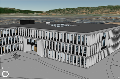
With the release of ArcGIS Pro 2.3, Esri has introduced yet another 3D building content format that is targeted at the Architecture, Engineering, and Construction (AEC) market, in order to realize better GIS and BIM integration.
What is a Building Scene Layer?
Esri’s new Building Scene Layer format is a logical step after the read capabilities of Revit data in ArcGIS Pro. In hindsight, this was a first step into bringing BIM data into ArcGIS Pro, but the data couldn´t be shared among other ArcGIS applications. The new Building Scene Layer is a solution to this problem, as it enables 3D building information to be streamed as an I3S scene layer. Introduces a new geoprocessing tool to create Building Scene Layers from “specific data types” (meaning Revit), it becomes shareable across the ArcGIS platform.
A Building Scene Layer (BSL) meets the demands of the has Architecture, Engineering, and Construction market for better GIS and BIM integration, as it was designed to maintain the semantic structure of the information in a building model, while capturing geometry and attributes that can be used in a GIS. BSLs can be created, displayed, with additional visual filters if necessary inside of ArcGIS Pro as local file content. Additionally, they can be published as web layers in ArcGIS Online or ArcGIS Enterprise.
Structure of a Building Scene Layer
A Building Scene Layer consists of the following four layer types:
- An Overview layer showing the 3D building as a single layer;
- A Discipline layer that groups category layers into the different work disciplines of a layer;
- Multiple category layers that represent individual objects, such as windows and doors;
- Filters that allow viewing specific details of a building.
Working with Building Scene Layers
A Building Scene Layer can be created inside ArcGIS Pro using the Create Building Scene Layer geoprocessing tool. Not all layers are added to the newly created layer from the Revit data, as only category layers with content are added to the building scene layer, while all others are removed. In case a discipline layer does not include category layers, the discipline layer is not added to the building scene layer. Finally, building scene layers can be shared as a web scene layer or within a web scene. Any filters won’t be included as they can only be used inside of ArcGIS Pro.
Building Scene Layers and I3S
The new Building Scene Layer format is now part of Esri’s recently updated specification of I3S, which stands for Indexed 3D Scene. The first specification was published by Esri in 2015 as an open specification as a technology for packaging and streaming large, heterogeneously distributed 3D data sets. An I3S dataset is now commonly known as a scene layer. They can consume a wide range of Esri data formats and are used throughout the ArcGIS platform. With regards to improving the capability of Building Scene Layers, Esri plans to create more sources rather than Revit files, such as GDB and IFC, as well as updating workflows to add more models or delete/update content in a layer.

