

16th Anniversary Sale
Our 16th annual Anniversary Sale runs through May 31st. As always, the sooner you register for a class the more you save. This includes our Annual GIS Training License, Live Classes, ArcGIS Pro Bundle, and Self-Paced Classes. You can use the discount code...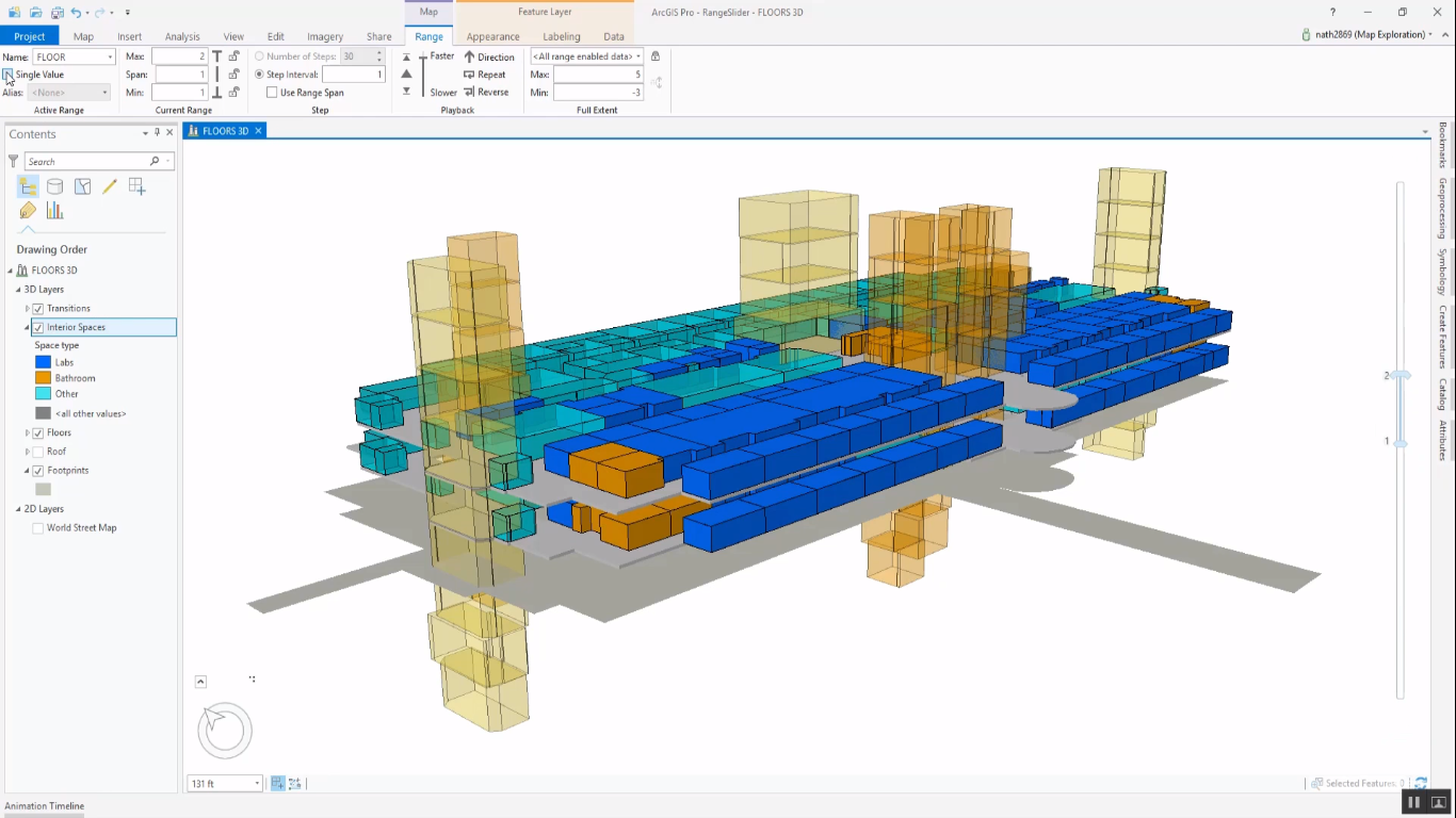
Filtering Data with the ArcGIS Pro Range Slider
This article describes how to use the Range Slider tool in ArcGIS Pro that functions as a display filter for 2D and 3D data. Each layer in ArcGIS Pro comes with a set of properties, that can be accessed and managed through the Layer Properties dialog window. The Layer...
Working with Jupyter Notebooks inside of ArcGIS Pro
The latest release of Pro integrates Jupyter Notebooks. This blog post describes the benefits of integrating them in Pro projects and workflows. The 2.5 release of Pro comes with the Juypter Notebooks application installed. What’s more, Jupyter Notebooks have been...