
One of the more difficult aspects of getting up to speed with GIS software is the wide variety of data formats that can be used. Just to name a few we have two or three types of geodatabase including file and enterprise for ArcGIS Pro and a third, personal geodatabases, for ArcMap. Each geodatabase can include feature datasets, feature classes, rasters, and stand-alone tables along with several other less commonly used formats. In addition, we still frequently use shapefiles and to a lesser degree we use DEM and TIN datasets. Web service layers streamed from ArcGIS Online or ArcGIS Enterprise are being used more and more as well. At times we may even load point data from csv files and other spreadsheet formats. And what are these things called packages? Obviously this is a lot to grasp if you’re new to GIS, and it’s easy to get overwhelmed. It’s easy to understand why many GIS professionals, when confronting yet another format simply can’t digest the information and understand how one format is different from all the other formats.
At the risk of introducing you to yet another format I am going to do just that in this article because there are some significant advantages provided by what is known as map and layer files. Map and layer files, while representing yet another format, do provide some significant advantages that you need to be aware of and are generally easy to use. By the end of this article you’ll have a much better understanding of what these file types are and how you can use them effectively.
What are Map and Layer Files?
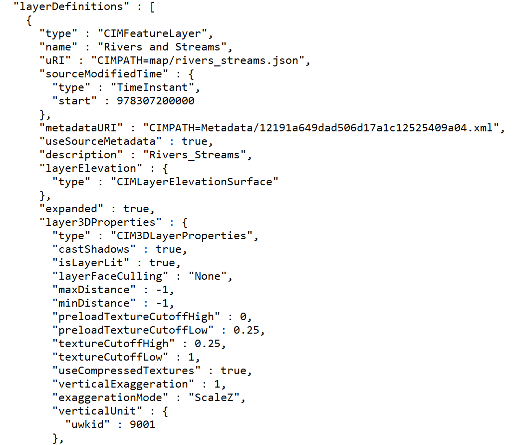
Map and layer files are basically just text files that contain information related to a GIS dataset. Technically, if you open one of these files in an application such as Notepad the format appears to be JSON and is simply a set of descriptors about a dataset. You can see an example of this below. Don’t worry if none of what you see makes any sense. The important part is that ArcGIS Pro knows how to read and interpret this information. However, you should note that these filed DO NOT contain any data. When ArcGIS Pro reads this type of file it extracts information such as the location of the dataset, symbology to apply the layer, labeling information, and any other properties associated with the layer file.
Layer Files
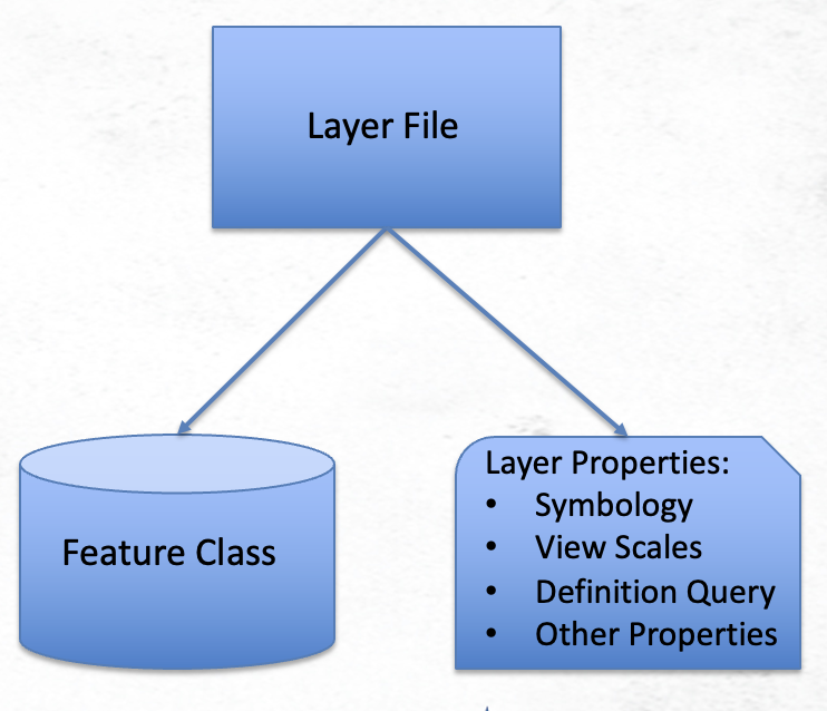
Layer files are simply text files that contain information about a dataset. This information includes a reference to a feature class in a geodatabase or a shapefile along with a set of layer properties. The layer properties include the symbology associated with the layer, view scales, definition queries, and any other properties defined for the layer. Keep in mind though that layer files do not contain any actual data, they simply reference a dataset. You can see an illustration of this below.
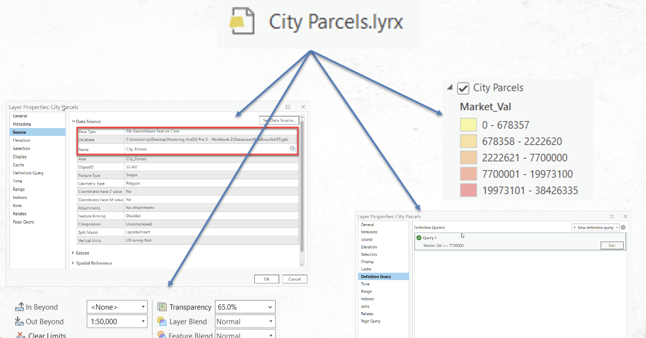
This is further illustrated below. Here was have a layer filed called City Parcels.lyrx. This file, which again is basically just a text file, includes a reference to a feature class or shapefile along with how the layer should be symbolized, map scales at which the layer should be visible, a definition query, and any other property found on the Layer Properties dialog.
When this City Parcels.lyrx file is loaded into a map in ArcGIS Pro, the feature class is retrieved, and the symbology and other properties are automatically applied. The key here is that you must have access to the feature class or shapefile referenced by the layer file and it must be in the same location specified when the layer file was created. If not, the data will not be displayed in the map and you’ll be left with a broken data link for the layer. This can be repaired and pointed to a new location, but obviously that’s not ideal.
Map Files
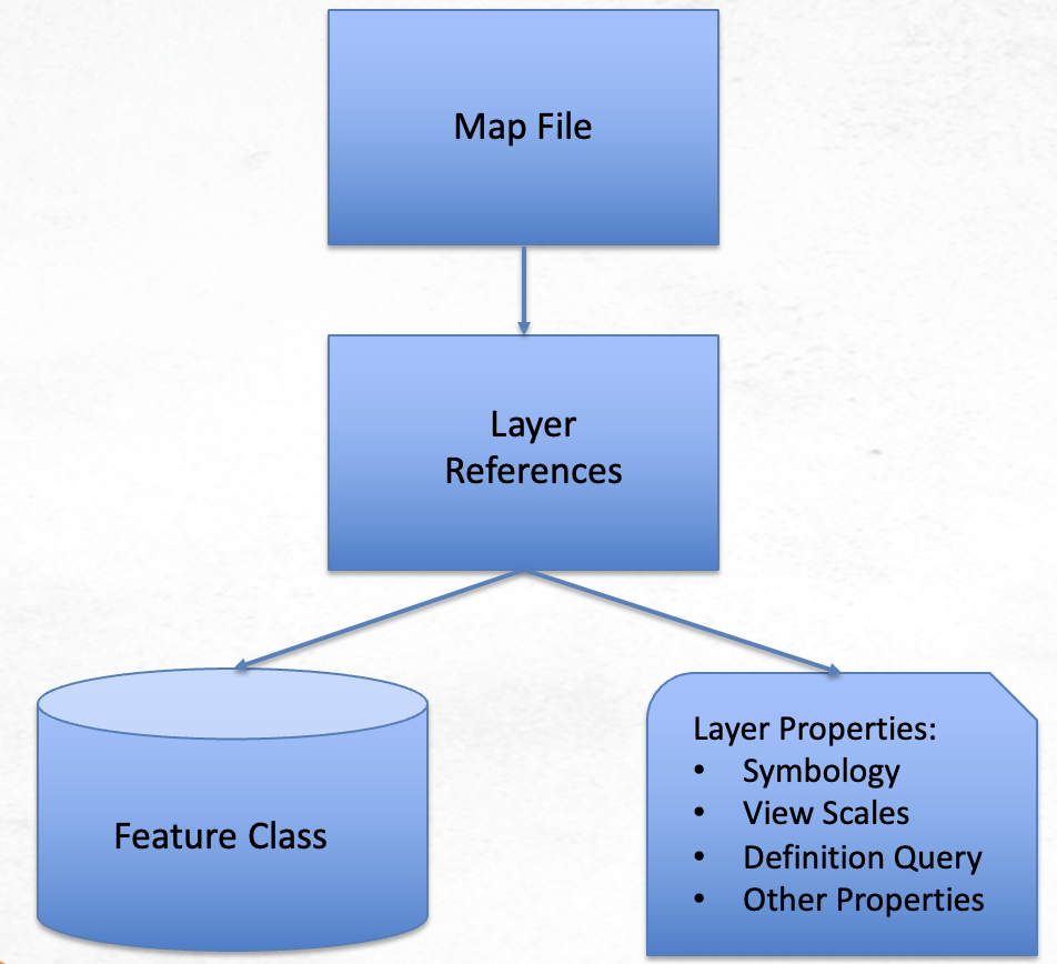
Map files are a logical extension of layer files. They are simply text files that contain references to all layers in a specific map. For each layer in the map a set of properties is stored in the file in exactly the same way as found in layer files. When a map file is loaded into an ArcGIS Pro project all the layer information is imported into a new map.
Creating and Loading Layer Files
Creating a layer file in ArcGIS Pro is a simple process. I’ve put together a short video that explains how to create layer files and how to load them into a map.
Creating Map Files
Creating map files in ArcGIS Pro is an equally simple process. I’ve put together another video below that describes how to create a map file and then load it into a new project.
Advantages and Disadvantages of Map and Layer Files
As with other GIS data formats there are advantages and disadvantages of using map and layer files in ArcGIS Pro.
Let’s start with the advantages:
- All you to standardize the symbology and properties of a single layer or layers across maps and projects
- Easy to share with other GIS users in your organization
- Small size so they are easy share and move to different locations
- Can be used to apply symbology to other datasets (shapefiles or feature classes for example)
The primary disadvantage is that the user of a layer or map file must have access to the data referenced by the file in order to view the content. It is certainly possible to reset the data source to point the file to a different source though.
Hopefully this article has been helpful to anyone seeking more information on how and why to use layer and map files. If you’d like to learn more information about how to use ArcGIS Pro we have a wide variety of training classes and options. Please see our live-online class schedule, in-person training schedule, and our self-paced training bundles.
