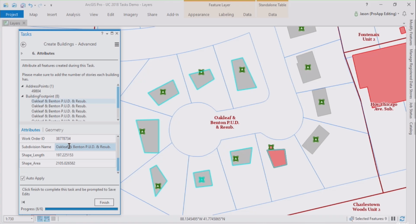
ArcGIS Pro introduced a new feature called tasks. This article explains how tasks can help ArcGIS Pro users to be more productive, as well as the different components that form a task.
What is a task?
Tasks are similar to wizards that guide a user through a software installation process, using sequential steps that inform the user what needs to be done next. In ArcGIS Pro, tasks are used to guide users through repeatable workflows, for example creating new features in a polygon layer. Similar to installation wizards, tasks are interactive as they require user input before one can move to the next step. For ArcGIS Pro workflows that don’t require user input, the Model Builder can be used.
What are tasks used for?
Tasks were introduced to improve efficiency. This means that when using a task, users can reduce the number of mouse clicks necessary to complete a workflow significantly, for example for turning layers on and off or manipulate a selection. Also, it’s no longer necessary to search for the right geoprocessing tools as these can all be configured beforehand inside. All this can save users a lot of time, making them more productive. Tasks are also examples of “best practices”, improving the quality of map products and data inside an organization. For example, costly mistakes can be avoided by configuring which layers are editable, or which datasets need to be used for a certain task.
Tasks need to be created before they can be used by others. A special task framework that enables the creation of new tasks. This can be done inside of Pro and there’s no coding experience required: a special wizard guides the user through the process. Tasks are fully configurable, enabling users to create new tasks using the organization’s language instead of pure geospatial jargon of the Pro application. This can help users better understand what a certain task does.
The building blocks of a task
Tasks consist of multiple task steps. These are the most important building blocks of a task. A single task step consists of four components: general, actions, view and content. Each of these need to be defined by a user when creating a new task. The components that make up a task step explained in more detail:
“General” refers to user instructions and behavior of a step. For example, a user will see a text box with a “run” button or button that says “press next step” to continue to the subsequent task step. Behavior refers to how a step is executed: the options are manually (using two mouse clicks), autorun (one mouse click) or automatic (no mouse clicks required).
“Actions” are the most important component of a task step, defining the required geoprocessing tools, models or script tools inside of Pro to complete a task. Here, users make selections of the map features to include as input for a geoprocessing tool. Verification actions catch errors when they’re happening and can prevent a user from proceeding to the next step if something was done wrong. Feedback messages can communicate the actual error with the user and what they need to do to comply with the verification error to be able to continue.
“View” refers to automatically open or close map views or layouts, to decide which map view will be active one for the required task step action. Using link map views, you can open and zoom to the same location of a different map.
“Content” enable the active map, layer visibility control, as well as snapping, editing, and selection functionality. Labels can be turned on or off if necessary. Additionally, snapping manipulation might be applicable for utilities to know users are snapping to the right features when they’re creating map features.

