Why do things break in Experience Builder after software updates?
There is a lot going on in the background of our application builders that we don’t see. The scripts that drive our applications, the backend connections that allow us to streamline our workflows, the security updates and patches that need to be updated as quickly as vulnerabilities are being created by hackers and evolving technologies. The complexities hidden deep within our application builders are something that we don’t have to deal with as front-end users.
When updates happen to the code that allows your widgets and applications to function the way they do, it should be expected that the backend change may break a connection you have on the frontend and force you to complete some troubleshooting steps.
What to do when something breaks after an update?
There can be differences in how something breaks, depending on whether you are in Portal or ArcGIS Online. Unfortunately, Portal will sometimes have an issue that cannot be fixed through the below steps and may be broken until the next patch or update. But for those of you in ArcGIS Online, the below steps are my typical approach and more often than not, the issue is resolved with step 1 or step 2.
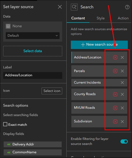
- Reconnect your data source(s) in the current widget. This can be painful, depending on how complex your configuration is, but often it’s as simple as deleting your data source connection to the widget and then reconnecting it. This means you will have to reconfigure the specific settings for that data source. Your action settings are not always affected by this, but it’s a good idea to check after you reconnect the data source and reconfigure it. If your actions are not working, delete all of them and reconfigure them again.
- Pull in and configure a new widget. If the above does not work, then deleting the current widget from your layout and pulling in a new widget typically resolves the issue. If there are enough changes in the back end of the developer code for a widget, then it will make sense that pulling in a new widget entirely will fix the issue.
- Search/Post the issue in the Experience Builder Community under ESRI’s community pages. If the above steps don’t work, search the ESRI Experience Builder community. If you don’t find another post already discussing the issue you are seeing, then create a post under the question category. Be sure to add words such as “error”, “broken”, etc. to your subject line and tags so that your post stands out. Because Experience Builder is the latest and greatest application builder for ESRI, they scan this forum regularly and you will be able to get a response quickly.
- Open a Ticket. Though incredibly painful, your last resort will be to put in a ticket with ESRI technical support. As previously mentioned, because Experience Builder is the latest and greatest, ESRI is putting forth a lot of energy and your issue will likely get resolved quickly or allow ESRI to put in a bug and get a patch added to the next update. If the bug impacts a large number of users, a patch may even be pushed through sooner than the next update.
We understand how frustrating it can be to have to reconfigure applications that were working exactly the way we wanted them to before an update. On the other hand, we are extremely grateful for the expanding functionality of Experience Builder so we try to take it in stride.
To view more articles and tutorials on Experience Builder, click the button below. If you want to learn how to become more productive in Experience Builder, check out our upcoming Experience Builder training events.

