

Effective communication of data and insights is crucial to GIS professionals. ArcGIS Pro 3.3 introduces an exciting feature that revolutionizes the way we present geographic information: interactive presentations. Whether you’re a GIS professional, educator, or enthusiast, ArcGIS Pro’s presentation capabilities allow you to craft compelling narratives that engage and inform your audience.
What are Presentations in ArcGIS Pro 3.3?
Presentations in ArcGIS Pro 3.3 function similarly to traditional slide-based presentations but with enhanced interactive capabilities. Each slide can showcase different 2D maps, 3D scenes, blank pages, images, or videos, allowing you to guide your audience through a visually rich and dynamic storytelling experience.
Key Features
1. Interactive Slideshows:
Transform your static maps and scenes into an engaging slideshow that can highlight specific data points, trends, or geographic patterns.
2. Customization:
Tailor each slide to emphasize critical information. Add annotations, graphics, and other visual elements to enhance clarity and impact.
3. Transitions and Animations:
Use smooth transitions and animations to create a seamless flow between slides, maintaining audience interest and enhancing the overall presentation quality.
4. Integration with ArcGIS Content:
Seamlessly incorporate various types of geographic content from your ArcGIS Pro project, including 2D maps, 3D scenes, images, or video.
5. Sharing and Collaboration:
Easily share your presentations within your organization or export them for external use, facilitating collaboration and broad dissemination of your insights.
6. Effective Storytelling:
Leverage the power of storytelling by guiding your audience through a sequence of geographic data and analyses, providing context and insights that resonate.
Creating a Presentation
Here’s a quick guide to getting started with presentations in ArcGIS Pro 3.3:
1. Prepare Your Content:
Ensure your maps and scenes are organized and ready within your ArcGIS Pro project.
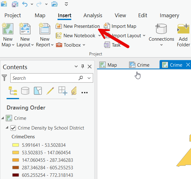
2. Create a New Presentation:
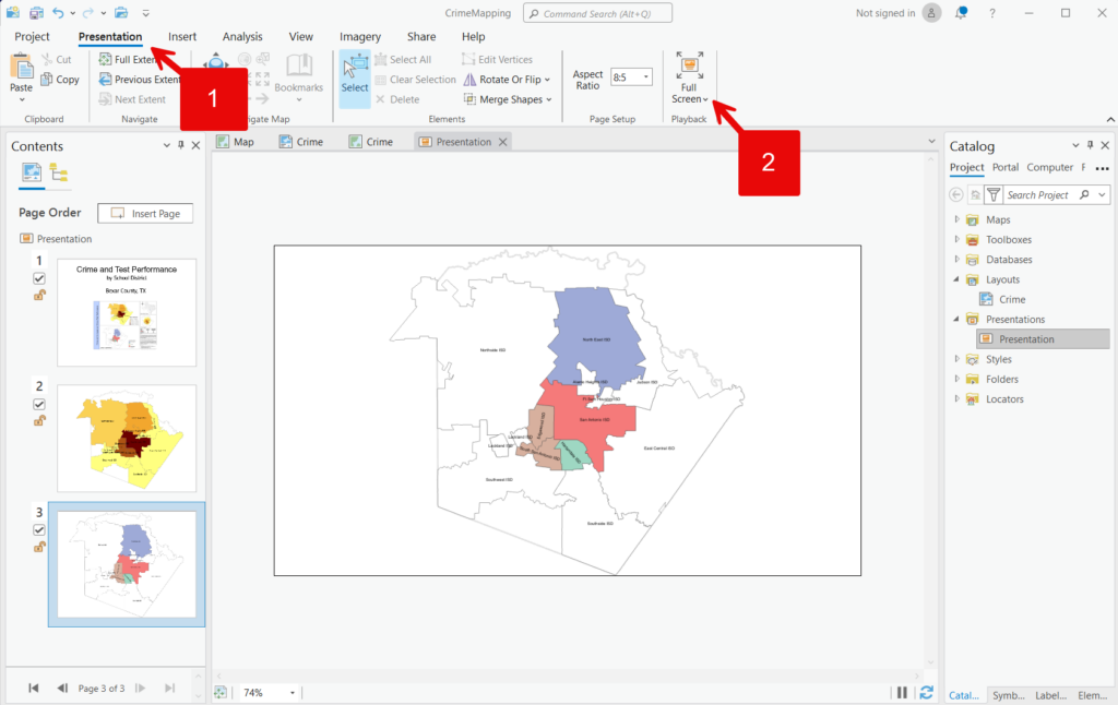
Navigate to the “Insert” tab and select “New Presentation” to open a new presentation window.
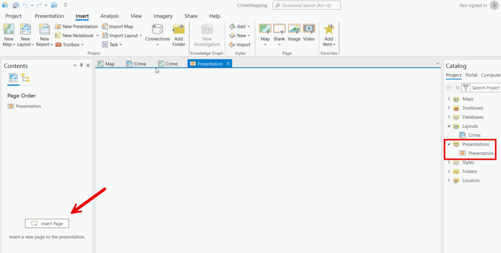
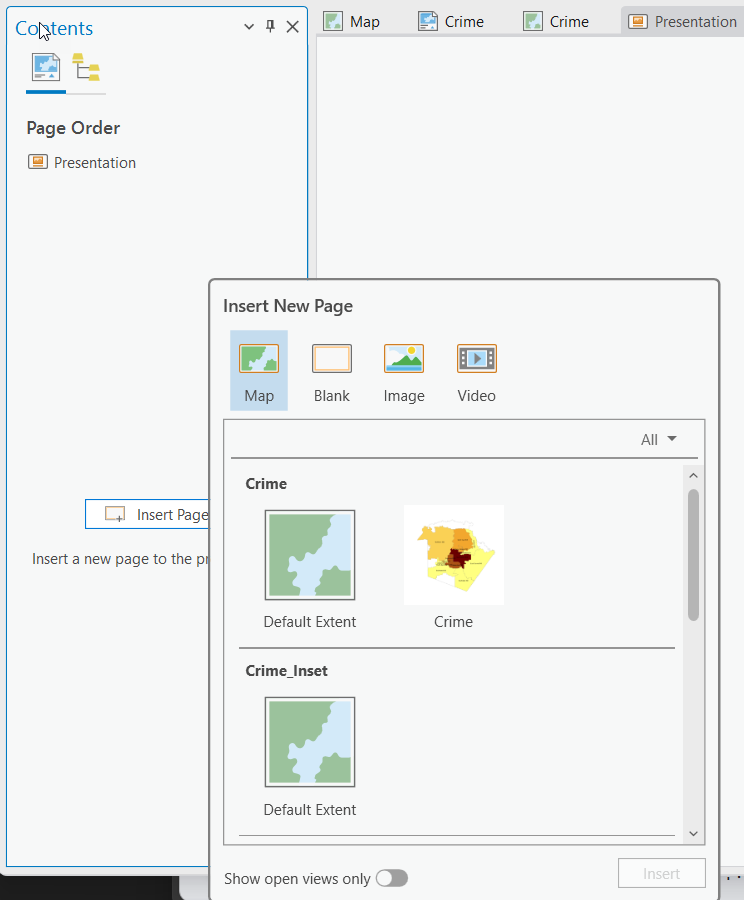
3. Add and Customize Slides:
Add new slides by clicking “Insert Page” and choose the type of content to display. Each slide can include content from a 2D map, 3D scene, blank page that can be customized with annotation and graphics, images, or video. Customize each slide with annotations, graphics, and other visual enhancements.
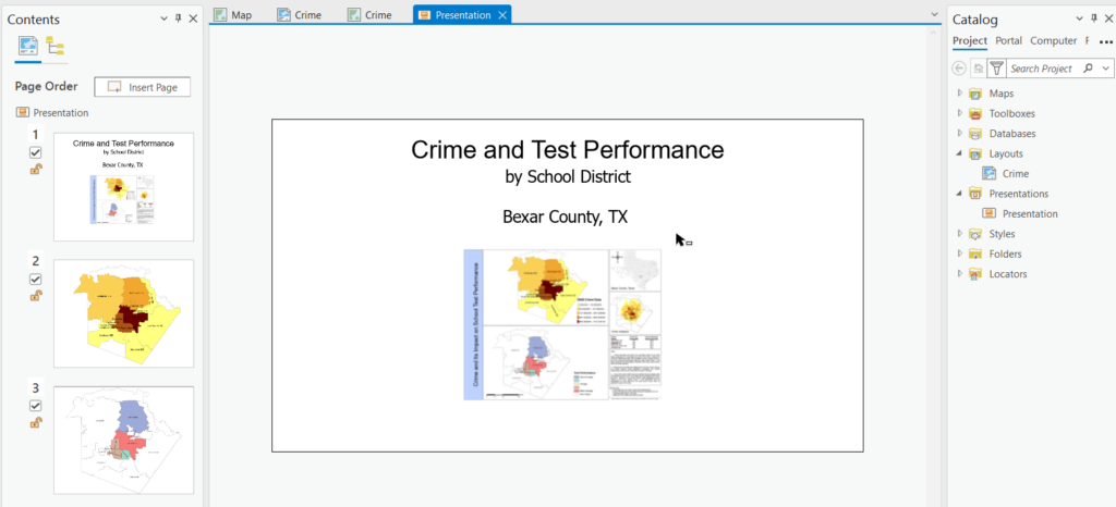
4. Arrange and Enhance:
Organize the slide order for a logical flow. Add transitions and animations to create a polished, professional presentation.
5. Preview, Save, and Share:
Preview your presentation, make any necessary adjustments, and save. Share your presentation within your organization or export it for broader distribution to a variety of image and video formats or PDF.
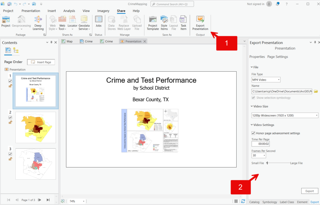
Output Presentation Video
Why Use Presentations in ArcGIS Pro?
Presentations in ArcGIS Pro 3.3 offer a powerful way to combine geographic data with narrative storytelling. They transform complex information into accessible, engaging, and visually appealing content. This feature is invaluable for professionals who need to convey geographic insights, educators looking to enhance learning experiences, and anyone passionate about sharing the story behind the data.
Unlock the full potential of your geographic data with presentations in ArcGIS Pro 3.3. Start creating captivating, interactive stories that inform, engage, and inspire your audience today.
