

If you’re working in ArcGIS Pro or ArcGIS Online and haven’t tapped into the ArcGIS Living Atlas of the World, you’re missing out on one of the most powerful resources available to GIS professionals today. This massive, curated collection of ready-to-use geospatial content can transform how you work—saving you countless hours while providing access to authoritative data you can trust.
What is the ArcGIS Living Atlas?
The ArcGIS Living Atlas of the World is one of the most comprehensive digital repositories of spatial content available today, built directly into ArcGIS. Launched in the mid-2010s alongside ArcGIS Online, it’s an evolving collection of thousands of layers, maps, apps, and tools contributed by the global GIS community, government agencies, scientific organizations, and Esri.
Think of it as a geospatial search engine—except instead of just finding data, you get instant access to ready-to-use, professionally curated content that’s already formatted, documented, and optimized for your GIS workflows.
Why Living Atlas Should Be Your First Stop for Data
1. Say Goodbye to the Traditional Data Hunt
Remember the old workflow? Search for data sources, download raw files, wrangle them into the right format, decipher confusing metadata, process and clean the data, and finally—finally—start your actual GIS work. That process could eat up hours or even days of your project timeline.
Living Atlas eliminates this friction entirely. The data is already processed, properly formatted, well-documented, and ready to add directly to your maps and projects. You go from searching to analyzing in minutes, not days.
2. Authoritative, Trustworthy Data
Not all data sources are created equal. When you’re making important decisions or presenting to stakeholders, you need to be confident in your data sources. Living Atlas content is carefully curated and reviewed to ensure quality and reliability.
Many items carry an “Authoritative” badge, indicating that the organization providing the data has been verified as an authoritative source. You’ll also see “Subscriber” and “Premium” badges that indicate access requirements—some content requires an organizational ArcGIS account or may consume credits when used in analysis.
You’ll find data from trusted providers like:
- NASA Earth Science data (integrated through a cooperative Space Act Agreement)
- U.S. Census Bureau
- NOAA (National Oceanic and Atmospheric Administration)
- EPA (Environmental Protection Agency)
- FEMA
- International distributors and regional partners
- Leading scientific institutions
- Esri-maintained reference layers and basemaps
3. Constantly Updated, Always Current
Many Living Atlas layers are live feeds or frequently updated layers—some refresh automatically hourly, daily, or at regular intervals depending on the data source. This means you can work with current information without having to manually download and update datasets. (Note: Not all layers are real-time; many are static or updated periodically based on the nature of the data.)
Examples of live or frequently updated content include:
- Real-time weather data
- Live traffic and transportation feeds
- Current wildfire locations
- Earthquake activity (via USGS feeds)
- Air quality monitoring stations
- Hurricane and severe weather tracking
You can check the Live Feeds Status page to see which feeds are currently active.
For dynamic situations like emergency response, environmental monitoring, or operational dashboards, this regularly updated data is invaluable.
4. Massive Variety of Content Categories
The breadth of content available in Living Atlas is staggering. Whatever your project needs, there’s likely relevant data waiting for you:
Basemaps & Imagery:
- High-resolution satellite imagery
- Street maps and topographic basemaps
- Historical imagery through the World Imagery Wayback app
- 40+ years of Landsat data
- Ocean basemaps
Demographics & People:
- Population estimates and projections
- Census data and boundaries
- Lifestyle and spending patterns
- Age, income, and education demographics
Environment & Earth Observations:
- Land cover and vegetation
- Climate and weather data
- Wildfire risk and monitoring
- Water resources and hydrology
- Air quality monitoring
- Sea surface temperature
- Chlorophyll-a measurements
Infrastructure & Transportation:
- Road networks
- Transit systems
- Utilities and pipelines
- Building footprints
Boundaries & Places:
- Administrative boundaries
- ZIP codes and postal codes
- Cities and landmarks
- Protected areas
3D Content & Elevation:
- Digital elevation models
- Topobathy (land and seafloor) elevation
- 3D building models
- Terrain and hillshade layers
5. More Than Just Data Layers
Living Atlas isn’t limited to raw data layers. It includes:
Ready-to-Use Maps: Professionally designed web maps with thoughtful cartography and configuration that you can use as-is or customize for your needs.
Apps: Interactive applications built on Living Atlas data, like:
- Air Quality Aware
- Wildfire Aware
- Esri Maps for Public Policy
- Landsat Explorer
- Climate Mapping for Resilience and Adaptation
StoryMaps: Compelling narratives that combine maps, data, and multimedia to tell important stories.
Deep Learning Packages: Pre-trained models for feature detection, like building footprint extraction, that can dramatically speed up urban planning and development workflows. (Note: Using these models may require specific infrastructure, GPU resources, and understanding of compatibility with your ArcGIS version.)
Tools & Analysis Services: Geoprocessing tools and services that extend your analytical capabilities, including elevation services, geocoding, and enrichment services. Be aware that some premium analytical services may consume ArcGIS Online credits or require subscriber access.
The Power of Combining Living Atlas with Your Local Data
Here’s where Living Atlas truly shines: it’s designed to work seamlessly alongside your own local data sources. You don’t have to choose between Living Atlas and your local datasets—the real magic happens when you combine them.
Think of Living Atlas as your contextual foundation. You have the local, detailed data about your specific area of interest—your parcels, assets, infrastructure, or service areas. Living Atlas provides the broader context that helps you understand how your local data fits into regional, national, or global patterns.
How This Works in Practice:
Your local data: Parcel boundaries for your county
Living Atlas adds: Census demographics, income data, and lifestyle segmentation
Result: You can now analyze housing development opportunities, identify underserved areas, or target community services based on population characteristics—without having to purchase or maintain demographic datasets.
Your local data: Water distribution network and service connections
Living Atlas adds: Real-time weather data, climate projections, land cover, and elevation
Result: Model flood risk to critical infrastructure, assess drought vulnerability, and plan infrastructure improvements with environmental context you didn’t have before.
Your local data: Emergency service locations (fire stations, hospitals, police)
Living Atlas adds: Live traffic feeds, road networks, population density, and real-time weather
Result: Optimize response routes, identify coverage gaps, and coordinate emergency response with current conditions and population distribution.
Your local data: School district boundaries and enrollment numbers
Living Atlas adds: Demographic projections, income levels, and transportation networks
Result: Forecast future enrollment needs, identify areas needing new facilities, and ensure equitable access to educational resources.
Why This Approach is Game-Changing:
You maintain control: Your authoritative local data remains the foundation of your work. You’re simply enriching it with complementary global and regional content.
No data maintenance burden: Living Atlas layers are maintained by their authoritative sources. While you manage your local parcels and infrastructure, Esri and partner organizations handle updates to basemaps, demographics, imagery, and environmental data.
Fill the gaps instantly: Don’t have aerial imagery? Living Atlas provides it. Need demographic context? It’s there. Require historical land cover data? Already available. You can focus your resources on collecting and maintaining the unique local data only you can provide.
Consistent methodology: When multiple departments or organizations use the same Living Atlas layers for context, everyone works from the same baseline data. This ensures consistency in analysis and makes collaboration much easier.
Scale your analysis: Start with local data, validate your methods, then expand your analysis to neighboring jurisdictions or compare your area to regional or national patterns—all using the same contextual data from Living Atlas.
Real-World Applications: Local Data Meets Global Context
Urban Planning: Start with your local zoning and land use data. Add Living Atlas demographic projections, transportation networks, and environmental constraints. Now you can analyze development opportunities in the context of population growth trends and infrastructure capacity you might not have access to otherwise.
Emergency Management: Your local critical infrastructure and response assets are essential. Overlay them with Living Atlas real-time weather feeds, traffic data, flood zones, and population demographics. Suddenly you can coordinate responses with live conditions and understand which populations are most at risk—without maintaining all that data yourself.
Environmental Analysis: You maintain detailed monitoring data for your watershed or conservation area. Combine it with decades of Landsat imagery, regional land cover changes, and climate projections from Living Atlas. Now you can see your local trends in a broader temporal and spatial context, identifying whether changes are local phenomena or part of larger regional patterns.
Public Health: Your department tracks local health facilities and disease surveillance data. Add Living Atlas air quality monitoring, demographic vulnerability indices, and accessibility data. You can now identify environmental health risks and healthcare access gaps with a comprehensive view you couldn’t achieve with local data alone.
Public Works & Utilities: You know your infrastructure inside and out—every pipe, road, and asset. Layer in Living Atlas elevation data, soil types, land cover, and demographic growth projections. Plan infrastructure improvements and expansions with confidence, knowing you understand both current conditions and future demands.
Economic Development: Your local business licenses and employment data tell part of the story. Add Living Atlas consumer spending patterns, commute flows, and market segmentation. Present prospects with compelling site selection analysis backed by both local ground truth and regional market intelligence.
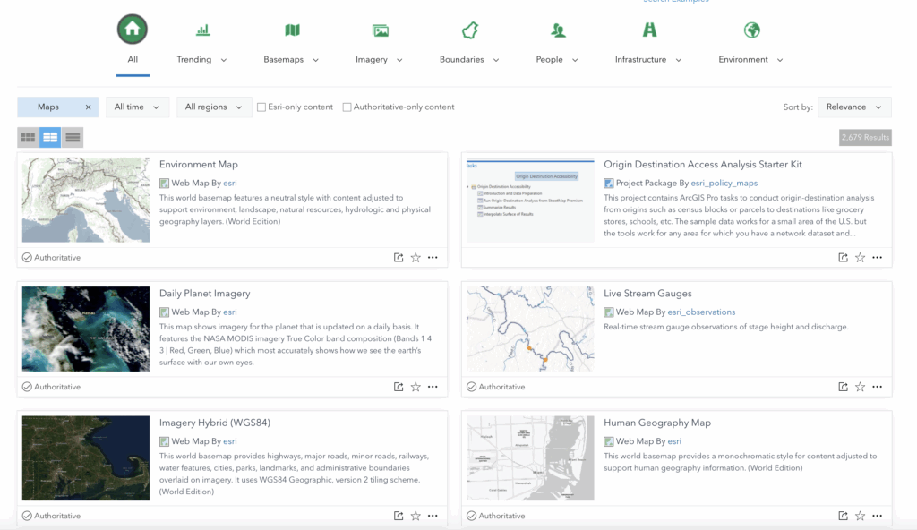
How to Access Living Atlas in ArcGIS Pro
One of the best features of Living Atlas is how seamlessly it integrates into your existing ArcGIS workflows. You don’t need to leave your project or navigate to external websites—it’s built right in.
Three easy ways to access Living Atlas in ArcGIS Pro:
- Catalog Pane: Open the Catalog pane, click Portal, and you’ll see Living Atlas content alongside your own data. Use the search bar or category filters to find what you need.
- Catalog View: Similar to the Catalog pane but in a full-window view for easier browsing of large content collections.
- Add Data Dialog: Click the Add Data button on your map, select Portal, and search or browse Living Atlas content to add directly to your current map.
You can filter content by category (Imagery, Basemaps, People, Environment, etc.) and search by keywords to quickly find relevant data.
Important Note for ArcGIS Enterprise Users: If you’re using Portal for ArcGIS (Enterprise), the Living Atlas content available to you is often a subset of what’s available in ArcGIS Online. This depends on your organization’s configuration, licensing, and internet connectivity. For disconnected Enterprise deployments, your administrator may need to replicate or host local copies of Living Atlas content using Living Atlas content packages.
Using Living Atlas in ArcGIS Online
In ArcGIS Online, accessing Living Atlas is just as straightforward:
- When creating or editing a map, click “Add” and then “Browse Living Atlas Layers”
- Search or browse by category
- Preview layers before adding them to your map
- Add multiple layers and configure them for your specific needs
The same authoritative, ready-to-use content is available whether you’re working in the desktop or online environment.
Understanding Access and Credits
Not all Living Atlas content is freely accessible. Here’s what you need to know:
- Open/Public Content: Many layers and basemaps are available to anyone, even without signing in
- Subscriber Content: Requires an organizational ArcGIS account to access
- Premium Content: May consume ArcGIS Online credits when used in analysis or for certain operations
Always check the item details page before incorporating content into production workflows. Look for badges indicating access requirements and review any credit consumption information for analytical services.
You can explore content and preview layers on the Living Atlas website to understand what’s available before committing to use specific datasets in your projects.
Tips for Making the Most of Living Atlas
Start with Living Atlas, then add your data: Rather than building everything from scratch, begin with relevant Living Atlas content as your foundation. Add your local or proprietary data on top to create richer, more comprehensive analyses. This “global context, local focus” approach gives you the best of both worlds.
Layer strategically: Think about the story your map needs to tell. Use Living Atlas basemaps and imagery as your canvas, add contextual layers (demographics, environment, infrastructure) in the middle, and place your authoritative local data on top where it rightfully takes center stage.
Leverage Living Atlas for what you don’t have: Take inventory of data gaps in your organization. Do you lack current imagery? Demographic projections? Environmental monitoring data? Transportation networks? Living Atlas likely has you covered, allowing you to redirect limited resources toward collecting truly unique local data.
Test analysis methods with Living Atlas first: Before investing in local data collection, prototype your analysis using Living Atlas data. Validate your methodology, refine your approach, and demonstrate value to stakeholders. Once proven, you can enhance the analysis with more detailed local datasets.
Check the item details: Click through to layer item pages to understand the data source, update frequency, geographic extent, and any usage limitations or subscriber requirements. This helps you determine if the data quality and update frequency match your local data standards. The metadata will tell you if a layer updates in real-time, daily, annually, or is static.
Understand the badges:
- Authoritative badge: The organization owning the content has been verified as an authoritative source
- Subscriber badge: Requires an organizational ArcGIS account to access
- Premium badge: May consume credits when used
These badges help you quickly assess data quality, trustworthiness, and access requirements.
Explore the apps: Don’t just grab layers—check out the ready-made apps. They can provide inspiration for your own projects or serve as starting points you can customize with your local data.
Use learning pathways: Esri provides tutorials and learning paths specifically for Living Atlas. These hands-on exercises can help you discover content you didn’t know existed and learn techniques for integrating it with your workflows.
Combine multiple sources: The real power comes from integrating multiple Living Atlas layers with each other and with your own data to gain new insights. Your local knowledge combined with global data creates analysis that neither source could achieve alone.
Document your sources: When presenting analysis that combines local data with Living Atlas content, clearly document all data sources. This transparency builds trust in your results and helps others understand the full picture of what informed your analysis.
Contributing Your Own Content
If your organization produces authoritative geospatial data, consider contributing to Living Atlas. By sharing your content, you make it accessible to millions of GIS users worldwide while establishing your organization as a trusted data provider.
The Living Atlas team curates submissions to ensure quality and usefulness, so your content benefits from their review process while gaining massive visibility within the GIS community.
The Bottom Line
The ArcGIS Living Atlas of the World represents a fundamental shift in how GIS professionals access and work with data. Instead of spending your valuable time hunting for data, downloading files, and wrestling with formats, you can immediately access thousands of high-quality, ready-to-use layers, maps, and tools.
But here’s the crucial insight: Living Atlas isn’t meant to replace your local data—it’s designed to enhance it. Your organization’s local datasets are irreplaceable. They represent your ground truth, your area of expertise, and your unique authority. Living Atlas provides the contextual framework that makes your local data more valuable and your analysis more comprehensive.
Think of it this way: Your local data tells the story of your community, jurisdiction, or service area. Living Atlas provides the broader narrative that helps you understand how that story fits into regional, national, and global patterns. Together, they create analysis that’s both locally authoritative and globally informed.
Whether you’re a seasoned GIS professional or just getting started, Living Atlas provides a competitive advantage: faster project starts, access to authoritative data sources, confidence in your results, and the ability to focus on analysis and problem-solving rather than data wrangling. Most importantly, it lets you extend the value of your local data investments by surrounding them with rich contextual information you couldn’t otherwise maintain.
Next time you start a project in ArcGIS Pro or ArcGIS Online, make Living Atlas your first stop. Build your foundation with Living Atlas content, add your authoritative local data on top, and watch your analysis reach new levels of insight and impact.
Ready to explore?
- Visit the ArcGIS Living Atlas website
- Browse all content
- Check out tutorials and learning resources
- Open ArcGIS Pro or ArcGIS Online and search “Living Atlas” in your Portal connection
