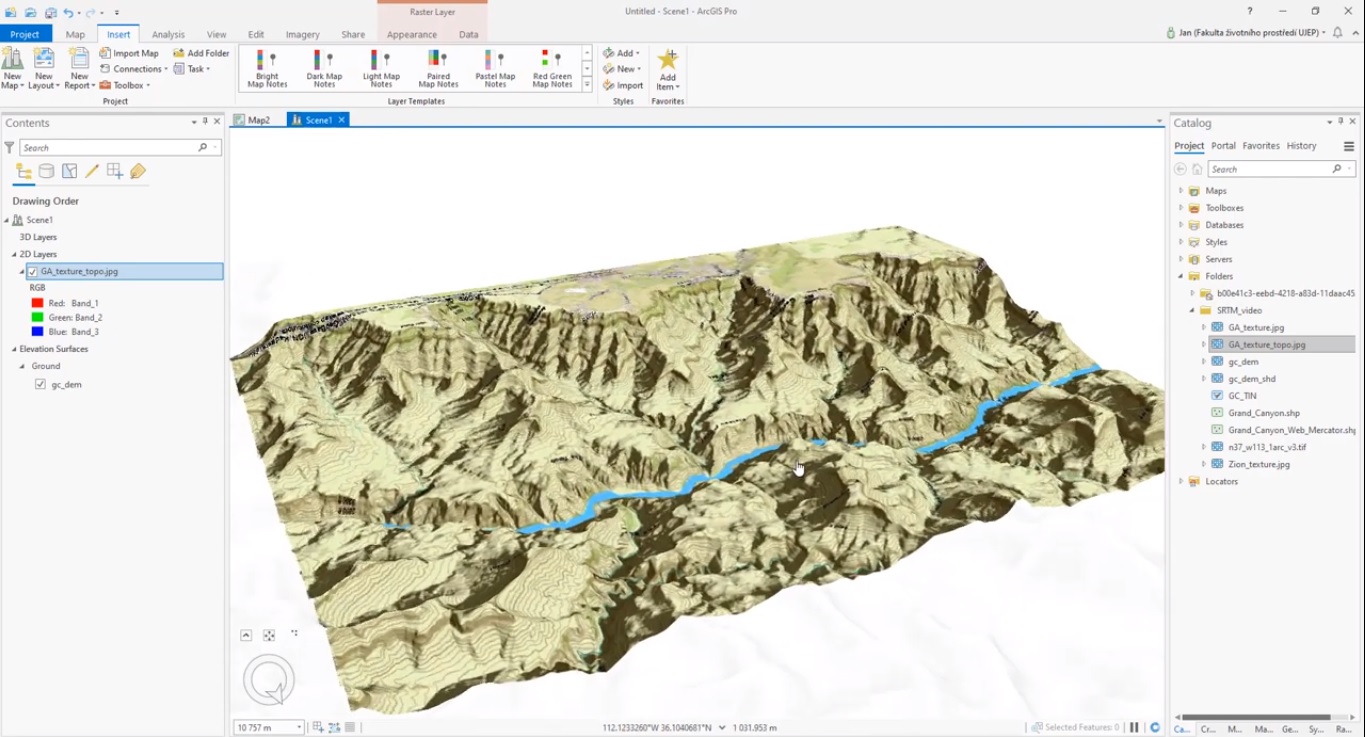
Using raster ArcGIS Pro’s geoprocessing and 3D Scene layer capabilities, raster data can be used to create and visualize Digital Elevation Models (DEMs) and derivatives, such as hillshade rasters and triangular irregular networks (TINs).
Creating a TIN with a point feature class
ArcGIS Pro enables the production of a triangular irregular network (TIN) layer. This is commonly an elevation surface that represents height values across an extent. A TIN is a special type of Digital Elevation Model (DEM) and is often (but not always) based on survey data. TIN layers are available in both map and scene views in ArcGIS Pro.
A TIN is an example of an interpolation tool: the term interpolation refers to a method of constructing new data points within the range of a discrete set of known data points (in this case, the elevation point data). Such points themselves can be derived from an input elevation dataset such as USGS 3D Elevation Program and convert raster data to point data using Pro’s “Raster to Points” geoprocessing tool. The result is a shapefile with evenly placed points placed at the center of a grid cell with a height value.
A TIN is created in Pro with the “Create TIN” geoprocessing tool. After searching and opening the tool, you need to define the output folder location of the TIN, the file name and define a coordinate system. Next, you define the Input Features, Height Field, Type and optional Tag Field. The output TIN is shown in the 2D map window in different color values. By inserting a New Local Scene, the TIN can be displayed in 3D shows in Contents pane under Elevation Surfaces, Ground. Copied to 2D layers it shows a 3D TIN, draped over Esri’s World Elevation data.
Raster Interpolation and Hillshade Raster creation
In addition to producing a TIN, the “Topo to Raster” geoprocessing tool can be used to interpolate a hydrologically correct raster surface from point, line, and polygon data. Using the same point data as used to produce the TIN as input features for the “Topo to Raster” tool, you need to additionally define their field and type, after which a new DEM is created. This tool also lets you define the output cell size based on the resolution of your input data. The result is a colored elevation grid that looks similar to the earlier produced TIN.
The visual results of the “Topo to Raster” geoprocessing tool can be used for creating a Hillshade Raster. Hillshades are “shaded relief” depictions of the landscape. They are very useful in manual image interpretation of vegetation types because they provide an instantaneous and easily understandable depiction of the relative slope, aspect, and elevation of any location.
They can be produced in ArcGIS Pro using the HillShade geoprocessing tool, which produces a grayscale 3D representation of the terrain surface, with the sun’s relative position taken into account for shading the image. The input is a raster file, while Azimuth, Altitude and Z-factor values can be defined by the user. The output is a Hillshade raster file in black, white and grey colors.
Sources:
“Imagery and GIS: Best practices for Extracting information from Imagery”, Esri Press
How to create DEM in ArcGIS Pro, Jan Pacina

