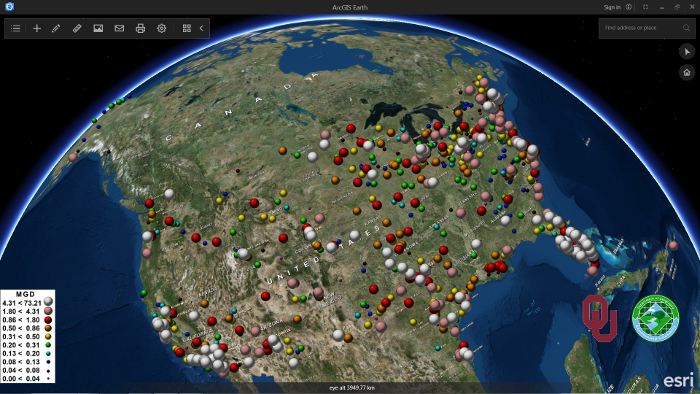
Last April, Esri announced the second release of ArcGIS Earth, version 1.1. This blog post discusses a number of new features that come with this new release, as well as Esri´s roadmap for upcoming releases and features.
Last January, Esri released a new software product called ArcGIS Earth, version 1.0. ArcGIS Earth is an interactive 3D globe viewer for data exploration and visualization tool. It supports Google Earth-like 3D navigation on Esri databases and services and integrates KML-oriented workflows. Version 1.1 followed in April, along with some new capabilities. As it stands now, the idea is to update the application every three months and there´s already a list of features that will be released in upcoming releases in the next two years.
New features in version 1.1
One of the new features in ArcGIS Earth 1.1 is time-enabled KML recognition. That means that when a time-enabled KML is added to the application, a time slider appears at the bottom center of the screen. ArcGIS Earth, ArcGIS Explorer for Desktop, and ArcGIS Pro all share the same KML engine and natively support KML with substantial OGC KML 2.2 compliance and even some of the recently added KML 2.3 support.
The second new feature lets users add OGC WMS and WMTS services in both WGS84 and Web Mercator spatial reference systems. Many ArcGIS for Server customers share out map data in WMS and WMTS to expose their data in standard, interoperable services. WMTS is often used instead of WMS to pre-cache tiles that may display more quickly than WMS.
Third, users can now load coordinate information by CSV or TXT file directly into the application. Users who are signed into a Portal for ArcGIS Server instance with a configured locator may also perform batch address geocoding. Batch address geocoding against the Esri World Geocoding Service is not yet supported in any configuration of Earth.
Last but not least, there are many administration and authentication improvements in version 1.1. From a user perspective, one of the major changes in version 1.1 is that it doesn’t require you to log in to your Esri account when starting the application in order to be using the application. The apps lets your visualizations, some basic measurement and visual analysis, time-enabled data without being logged into ArcGIS Online or Portal for ArcGIS. The option to sign in hasn’t disappeared though: signing into Earth with an Esri account gives you access to additional content, services, and the ability to access restricted data.
What´s next
Many new features are planned for upcoming releases of the application. Esri will be continuing to update and improve KML support into the future, including adding Map Tours (fly-throughs) later this year. For next year, there are plans for a customization API release, as well as Android or iOS versions of the application.
Features without a hard deadline include KML and possibly shapefile export, the possibility to publish directly to ArcGIS Online and Portal for ArcGIS Server, enhancement of the ability to do drawing on a map, and allowing users to configure their own map units and enhance measuring. In the future, users will have the ability to use their own terrain data (both as services or local files), create and share bookmarks and finally localize the app, with more language support other than standard English. Finally, Esri has promised future support for visualizing large mesh data, disconnected workflows, GIS compatibility features and saving data locally.

