

When it comes to geospatial applications, effective data presentation is paramount. Even more important is the ability to quickly create a simple application and then maintain it over time. ArcGIS Instant Apps offers a suite of simple templates designed to enhance user engagement and data interaction. Instant Apps are designed for quick deployment and focused functionality, allowing users to create interactive applications with minimal effort. Unlike more complex tools such as ArcGIS Dashboards or Experience Builder, Instant Apps provide a streamlined, user-friendly builder that enables rapid configuration without requiring extensive knowledge. This makes them an excellent choice for quickly delivering simple and targeted mapping solutions.
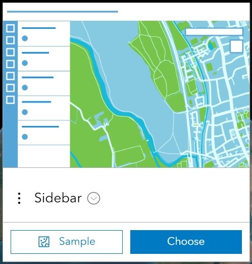
Out of the 20+ templates available, the Sidebar Instant App stands out to us as one of the more useful and versatile options. This application offers a balanced approach to robust functionality and data presentation without overwhelming the map interface.
In this article, we’ll explore why the Sidebar Instant App should be considered among your top application builders in your go-to geospatial toolkit.
Enhancing Data Exploration and Interaction
The Sidebar Instant App provides multiple ways for users to explore and interact with spatial data efficiently, making it easy to locate and engage with relevant features and functions. This section focuses on:
- Feature Pop-Ups in a Panel – Displays selected feature details in a dedicated sidebar.
- Search and Filter – Enables users to find and refine data dynamically.
- Bookmarks – Allows quick navigation to key locations.
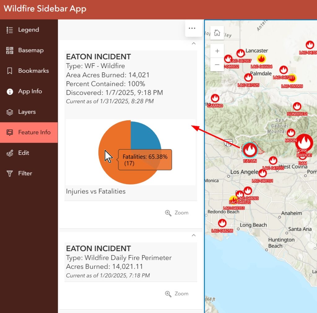
Feature Pop-Ups in a Panel
Traditional pop-ups can obstruct the map view and become cumbersome when dealing with multiple features. The Sidebar Instant App streamlines this by displaying feature details in a side panel, keeping the map clear while providing access to important information.
Search and Filter
Instead of manually scanning through a map, users can search for specific features or apply filters to refine displayed results. This function is especially useful for applications that contain large datasets, such as real estate listings or infrastructure asset management. It is also important for users to search on local data instead of the default ESRI World Geocoder, which Sidebar also allows.
Bookmarks
For applications covering a wide geographic area, bookmarks allow users to jump to predefined locations, reducing time spent panning and zooming. Whether highlighting project sites, city districts, or emergency response zones, bookmarks improve map usability.
Streamlining Data Access and Editing
Unlike many Instant Apps designed only for data visualization, the Sidebar Instant App allows users to edit feature attributes and geometry directly within the interface. In addition, for users who need to calculate distances and areas, the Sidebar Instant App includes built-in measurement tools. This section covers:
- Editing Capabilities – Enables users to modify feature attributes and geometry.
- Measurement Tools – Allows users to measure distances and areas directly on the map.
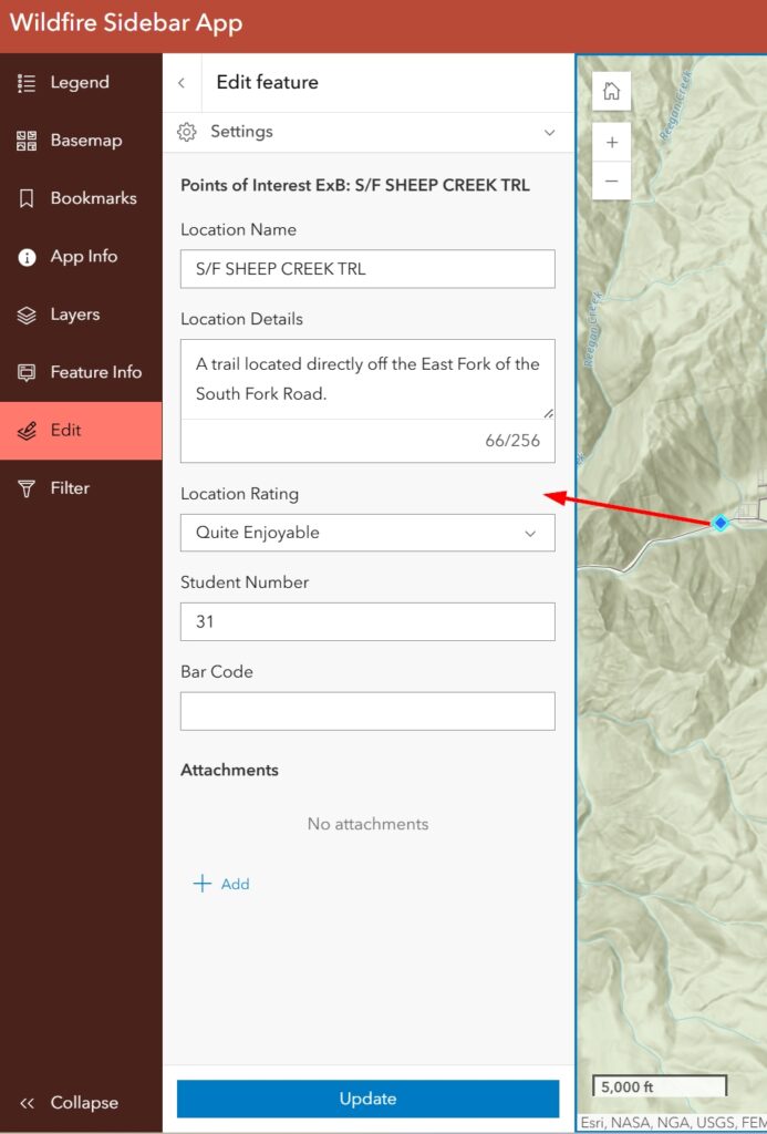
Editing Capabilities
By allowing users to edit spatial and attribute data in real time, this function is valuable for:
- Field data collection – Updating infrastructure conditions, asset inventories, or environmental surveys.
- Municipal and zoning updates – Adjusting land-use classifications or property boundaries.
- Utility management – Keeping infrastructure records up to date.
Measurement Tools
Instead of relying on external GIS software, users can perform simple distance and area calculations within the app. This is useful for:
- Urban planners analyzing distances between features.
- Emergency responders determining evacuation zones.
- Environmental scientists measuring habitat loss or land-use changes.
Ensuring Accessibility and Usability
Beyond its core GIS functions, the Sidebar Instant App prioritizes usability and accessibility, ensuring effortless interaction across different devices. This section focuses on:
- Screenshot and Export to PDF – Captures and saves maps for printing or reporting.
- Mobile-Responsive Design – Ensures functionality across desktops, tablets, and mobile devices.
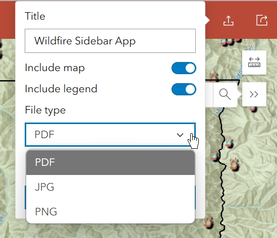
Screenshot and Export to PDF
Users can capture snapshots of the current map view and export them as PDFs, making it easier to share findings, generate reports, or document spatial insights. The screenshot can include the legend by default. Users can also decide to export the map directly to PDF, JPG or PNG in a very simple layout.
Mobile-Responsive Design
Whether in the office or in the field, the Sidebar Instant App automatically adapts to different screen sizes, ensuring a seamless user experience across all devices.
Final Thoughts
The Sidebar Instant App is a powerful yet easy-to-use addition to any geospatial toolkit. By combining interactive data exploration, advanced visualization, measurement tools, and editing capabilities, it allows users to analyze, update, and present spatial data with ease.
For those who need a simple, efficient way to deploy interactive web apps, the Sidebar Instant App offers the right balance of usability and functionality, making it a go-to choice for GIS professionals and non-GIS users alike.
What’s Next?
Looking for more ways to improve the GIS products you offer your community, staff, colleagues, or organization? Check out our guide on Widget Strategies for Data-Driven Dashboards in Experience Builder to take your GIS solutions even further.
