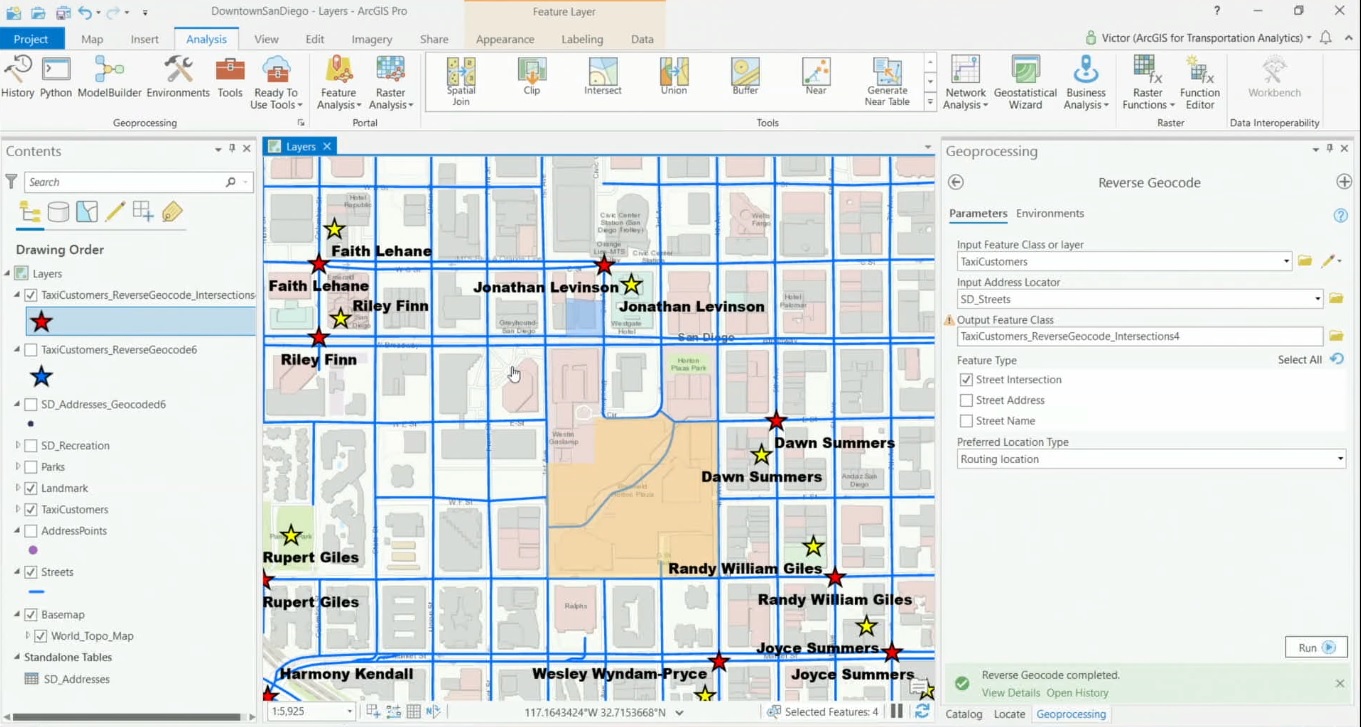
ArcGIS Pro offers a set of geoprocessing tools for translating addresses into locations and vice versa. User-defined tables and spreadsheets with many addresses can quickly be converted into points on a map from Pro’s content pane, while a geocoding service from ArcGIS Online can be accessed through Pro to perform geocoding operations as well.
Geocoding, reverse geocoding and batch geocoding explained
The process of taking an address and finding its corresponding location as a point on a map is called geocoding. The opposite, the process of translating a point on a map into the nearest address or place, is called reverse geocoding. Batch geocoding is taking a larger number of addresses stored in a spreadsheet or table and convert them into points on a map in one single operation. Users of ArcGIS Pro have several options for performing geocoding operations. It’s possible to use a geocoding service from ArcGIS Online, but ArcGIS Pro users can also use their own address and location data for geocoding operations.
Searching for addresses using the ArcGIS World Geocoding Service inside Pro
With an ArcGIS Online subscription as well as having Portal for ArcGIS installed, it’s possible to connect to Esri’s ArcGIS World Geocoding Service using the ArcGIS REST API and perform geocoding operations. The service finds addresses and places in all supported countries from a single endpoint. The output points can be visualized on a map, inserted as stops for a route, or loaded as input for spatial analysis. The service can be accessed through the Locate pane inside Pro.
The Locate pane has two tabs: Locate and Settings. In the Settings tab, you can enable various Locate providers, such as the aforementioned geocoding service. As you enter a search term in the Locate pane, the service will give you suggestions. It’s possible to search for POI’s or intersections and click on the map for suggestions of POI’s nearby, that are shown on the map in a popup.
Geocoding geoprocessing tools in ArcGIS Pro
ArcGIS Pro’s Geocoding toolset can be used to perform various geocoding operations using local location data without having to use Esri’s cloud services. Turning addresses into locations and vice versa is done with the Create Locator tool, found in the Geocoding toolset. A Locator is a tool that helps you translate addresses into locations. The Create Locator tool requires a set of parameters, such as the country or region where the locations or addresses can be found and the data used for building the Locator off, such as a local street dataset. It’s possible to use multiple primary tables for building a Locator, for example using both street addresses and point addresses for creating one output Locator. After ArcGIS Pro has created the Locator, it is added automatically to the project and Locate pane so it can be used to search for addresses, after marking the “enable” field.
Similarly as the last tool, the Create Composite Address Locator tool uses two or more existing locators together to create a streamlined search experience. This can be handy of you have an existing Locator that you want to utilize with a new Locator, or want to create a Composite Locator of your own Locator with the ArcGIS World Geocoding service so that addresses that can’t be found with your own local data can fall back on Esri’s geocoding services.
Batch geocoding and reverse geocoding with ArcGIS Pro
ArcGIS Pro offers a handy User Interface for geocoding multiple addresses in a table, that guides you through the process. The UI can be called with a left mouse click and selecting “geocode table” on an address table in the contents pane. In total, four steps are required to produce a feature class in a file geodatabase or shapefile with point features from an input Locator. The resulting points are added to the map window and a message is displayed stating how many addresses were matched.
There are two ways to perform reverse geocoding in ArcGIS Pro feature: by interacting with the map directly or using a geoprocessing tool. The first option is pretty straightforward: you can right click on any location in the map window and choose the option “what’s here?”. Next, a dotted line is placed between the user-defined point and the nearest address point.
Finally, the Reverse Geocode geoprocessing tool creates addresses from point locations in a feature class. The reverse geocoding process searches for the nearest address or intersection for the point location based on the specified search distance. This tool can also be used to reverse geocode the addresses of more than one point, for example an input feature class with multiple points without a nearest address. The address location that ArcGIS Pro uses to match these points can be a routing location (street side), or an address location, which refers to the roof top or centroid of a parcel.
Upcoming ArcGIS Pro Classes
Learning ArcGIS Pro 1: Maps and Projects
Learning ArcGIS Pro 2: Editing, Analysis, and Automation
Learning ArcGIS Pro 3: Converting, Linking, and Analyzing Data
Learning ArcGIS Pro 4: Sharing Your Maps and Data

