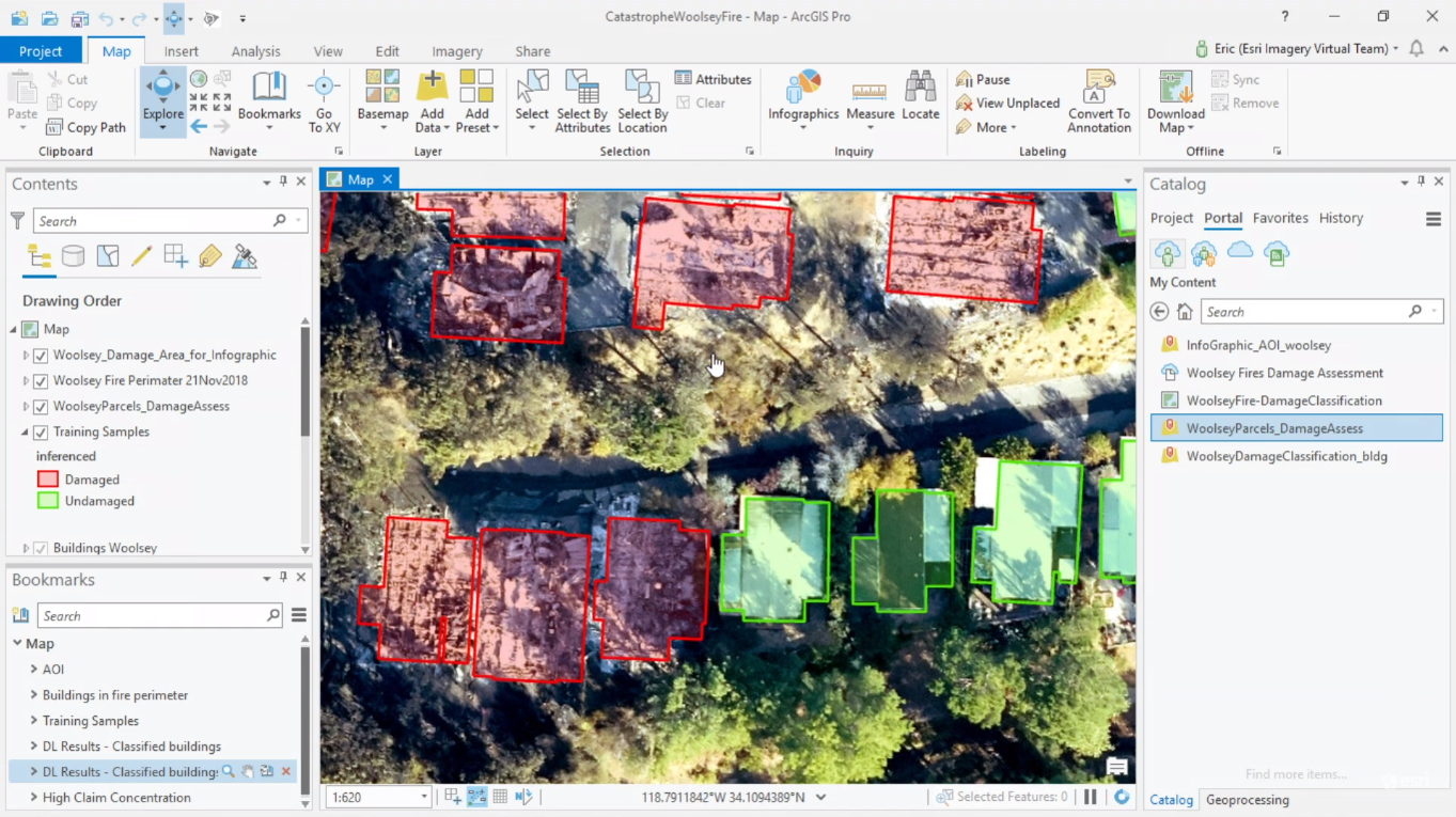
This year’s Esri User Conference plenary sessions featured a presentation showing how an insurance company in San Antonio, Texas uses ArcGIS Pro to train neural deep learning networks, in order to automate and speed up damage assessment and building footprint extraction based on drone imagery.
The United Services Automobile Association (USAA) is an insurance company based in San Antonio, Texas. Recognizing the impacts disasters have on its members, they developed multiple remote-sensing solutions to help members get back on their feet quicker. For example, they developed a GIS viewer that uses real-time weather data that is overlaid on building footprint data to monitor upcoming tropical storms and helps to minimize their impact on their members and their homes.
Towards a scalable solution
After the Woolsey fires, they used multiple image sources to do damage assessment: using oblique imagery along with other imagery gave them a better view of the type of objects that were located on members’ properties and to asses which of these were damaged or not. However, this solution was not scalable: it was not possible to check all properties individually using the viewer to see if there was damage or not in the case of major events where thousands of properties were damaged. To save time and money, the USAA developed a solution using deep learning techniques that could automatically perform damage classification of the members properties.
Today, deep learning techniques are used often for doing classification on imagery, using a model that “knows” how to correctly classify an image after having been shown many examples, thus mimicking the way humans learn. This type of learning is also called supervised learning, as humans need to produce these examples and classify them manually.
Automating damage assessment using drone imagery
The USAA’s deep learning solution consists of a workflow that starts with ArcGIS Pro, where the training data was produced by manually labelling a few hundred homes as damaged or undamaged as a result of the Woolsey fires. This information was added to a new field in the attribute table of an existing building footprint layer.
Next, the Export Training Data For Deep Learning tool in ArcGIS Pro was used to convert labeled vector or raster data into a deep learning training dataset. The resulting output of the tool is a folder of image chips and a folder of metadata files in the specified format. For this particular task, the specified format was ‘Labelled Tiles’, meaning they are labeled with a specific class, ‘damaged’ or ‘undamaged’.
The training data was next used to train the model using ArcGIS Notebooks and the arcgis.learning module from the Python API for ArcGIS, using only twelve lines of code and resulting in an accuracy of 99%. This model can be saved and made available to teams inside of an organization through ArcGIS Enterprise where it can be taken to scale, resulting in a feature service that can be brought back into ArcGIS Pro. The resulting workflows saves the USAA a lot of time when doing damage assessment, enabling them to attend affected clients more quickly in the case of a major event such as the Woolsey fires.

