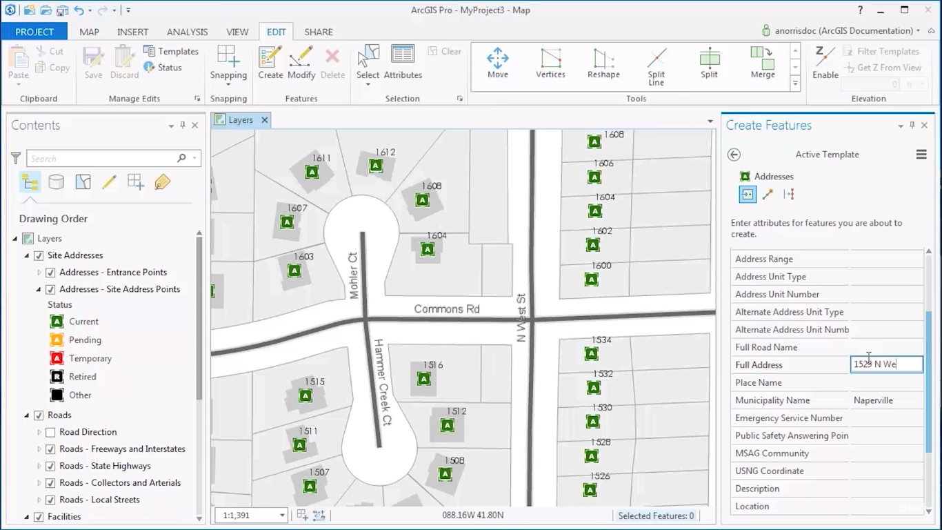
This article discusses what editing in ArcGIS Pro means and how editing functionality is different from ArcMap.
What does editing mean in the context of ArcGIS Pro?
The term “editing” in the context of ArcGIS Pro relates to changing the attribute information or geometry of a feature. Data editing is done many times in the lifecycle of a spatial dataset so that it reflects the current state of truth. Features that can be edited are points, lines, and polygons; editing therefore relates to vector data (a raster file, on the other hand, does not contain features, only pixel values). When a feature is edited, a GIS professional is changing its shape in a map window or its attributes inside an attribute table. Editing data mostly is about changing existing data, but it’s also common to create new data.
Editing features is a common task of a GIS user. Features change over time: think for example of a new residential area or highway. Also, the attribute data of existing features may change. For example, a parcel may change ownership over time, although its geometry does not change. This information is stored in an attribute table and can be edited by the user.
How does editing in ArcGIS Pro work and how is it different from ArcMap?
Editing in ArcMap used to be rather complicated. The map interface was not the most convenient way to perform spatially accurate edits. This also had something to do with ArcMap offering a limited set of editing tools that did not justify the complex geometries of spatial features. As a result, an editing procedure in ArcMap would require a lot of manual effort from a GIS professional. Map editing could not be automated, which required repetition of the same procedures over and over again for each edit, making it a time-consuming process.
Fortunately, editing in ArcGIS Pro has become a lot easier than with ArcMap: not only are there more editing tools that make it easier to realize edits, editing tools have also become smarter so that users can save time and effort. One example of this is the creation of edit templates so that new features automatically inherit attributes of the type of object class they belong to.
Editing in ArcGIS Pro differs from editing in ArcMap. Users in ArcMap were required to start an edit session, that enabled the use of various editing tools. After performing the edits in the map window or attribute table, the edits were saved and the edit session would be ended using the “stop editing” button. ArcGIS Pro does not have the option to start edit sessions nor uses an edit button, which means that edits can be made anytime. Instead, edits are saved by saving the entire project or using the save button in the Edit tab on the ribbon interface in Pro; inside of it, a features group gives access to editing tools for creating or modifying features. A simple “undo” button restores an edited feature to the situation before performing the edit.
Apart from editing points, lines and polygons, ArcGIS Pro supports editing without topology, as well as simple map topology and an established planar topology. A planar topology permits the user to specify rules about the spatial relationships between features, test when the rules are violated and fix these errors. ArcGIS Pro also enables creating and editing annotation as long they are stored in a geodatabase as a standard or feature-linked annotation.

