This blog post covers a selection of what´s new in ArcGIS Online. The enhancements and new features have been released as part of the 10.5 release of ArcGIS.
Map Viewer enhancements
You can use the new Arcade scripting language in the map viewer, for example for styling and labeling feature layers. This new scripting language comes with the 10.5 release. With regards to feature layer attribute tables, you can now edit or delete attributes directly in a table, and view and edit related records, photos, and files. The map viewer now supports labeling in ArcGIS Server map image layers that support dynamic layers.
Scene Viewer enhancements
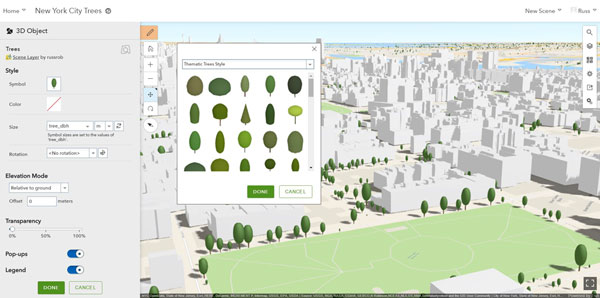
The Scene Viewer includes a new layer type called point cloud scene layers, that can be used for displaying point cloud data. These layers can be configured in ArcGIS Pro 1.4 and published to ArcGIS Online. Their appearance in ArcGIS Online is based on the chosen symbology renderer type, the options being Stretch, Classify, Unique Values or RGB. Vector tile layers can now be used in 3D as operational layers or as basemaps.
New Analysis tools
The Analysis button offers hosted analysis tools, such as the new Join Features and Find Outliers tools. The first tool enables transferring attributes from one layer or table to another based on spatial or attribute relationships, the second tool creates a map showing any statistically significant clusters and spatial outliers present in user data. The “Plan Routes”, “Find Nearest”, and “Connect Origins to Destinations” tools now have the ability to save the results as route layers, so that they can be shared with other members in the organization.
Hosted Web Layers updates
Multiple views of a hosted feature layer can be created as of this release, allowing users to publish data once and create tailored views for each audience, all referencing the same underlying data but with different capabilities, cartography, and filtering.
ArcGIS Content updates
Esri vector basemaps are no longer in beta and are available to use in production web maps and apps. The World Imagery basemap has been updated with additional sets of DigitalGlobe imagery for several countries, including detailed imagery for many metro areas.
Organization administration and account enhancements
Administrators can now leverage two levels of membership when assigning roles and privileges to members. These levels allow organizations to control the scope of privileges that can be assigned to members through roles. Level 1 membership is for members who only need privileges to view content that has been shared with them through the organization, as well as join groups within the organization. Level 2 membership is for members who need to view, create, and share content and own groups, in addition to other tasks.
Organizations can now configure social logins, allowing members to join the organization using their Facebook or Google login data. In addition, administrators can enable Esri access on the social logins so members have access to Esri web resources such as GeoNet.

