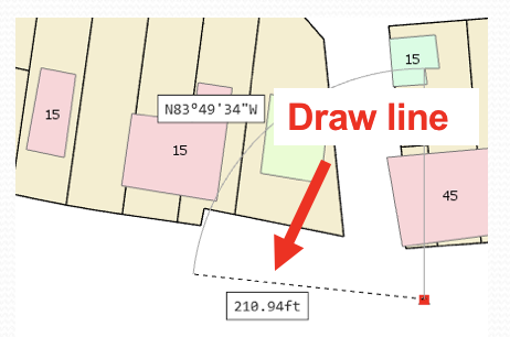
Why do you need or want to edit data in a GIS? For some the answer may seem obvious. But take a quick moment to think about it. One of my favorite questions that normally comes from managers or elected officials is “When will our GIS be done?”, as if a GIS is a house or a car. That is has a specific end or construction date. GIS is ever evolving and changing because the real world features it represents are always changing. Parcels are being merged, divided, bought and sold. New waterlines are being placed in service while others are removed. As long as the world we represent in our GIS is changing, we will need to update our GIS to reflect all those changes.
So what kind of data can we edit in our GIS? Again this may seem self evident but take some time to think that through as well. At a basic level there are two types of data we can edit with GIS, spatial and tabular. The spatial data maybe raster or vector. The tabular data maybe attributes associated with points, lines or polygons or stand alone tables. Then we can get more specialized and look at specific data formats such as shapefiles and geodatabases.
As mentioned before, we live in a world that is changing constantly. New features are being built, old ones are destroyed or retired, existing ones are sold or transformed. All of this needs to be reflected in our GIS. There are various ways you can create new data, such as
- Digitize the data from existing paper maps or plans
- Use web resources
- Develop the data through the use of field data collection
- Import data from other digital formats such as AutoCAD drawing or excel spreadsheets
You will also find a need to update and edit existing data so that it shows the current condition or state of features. ArcGIS Pro allows you to do this as well.
You can:
- Add to or remove features from existing data
- Alter or modify existing feature shapes and locations
- Update attributes
- Add new data fields
In this course you will learn how to use ArcGIS Pro to perform spatial and attribute edits.
Course Modules
Module 1: Editing Workflow and Options
Module 2: Creating New Features
Module 3: Creating New Features from Existing Features
Module 4: Editing Existing Features
Module 5: Editing Attributes
Module 6: Editing with Topologies
Get more information about this new class
Upcoming ArcGIS Pro Classes
Learning ArcGIS Pro 1: Maps and Projects
Learning ArcGIS Pro 2: Editing, Analysis, and Automation
Learning ArcGIS Pro 3: Converting, Linking, and Analyzing Data
Learning ArcGIS Pro 4: Sharing Your Maps and Data

