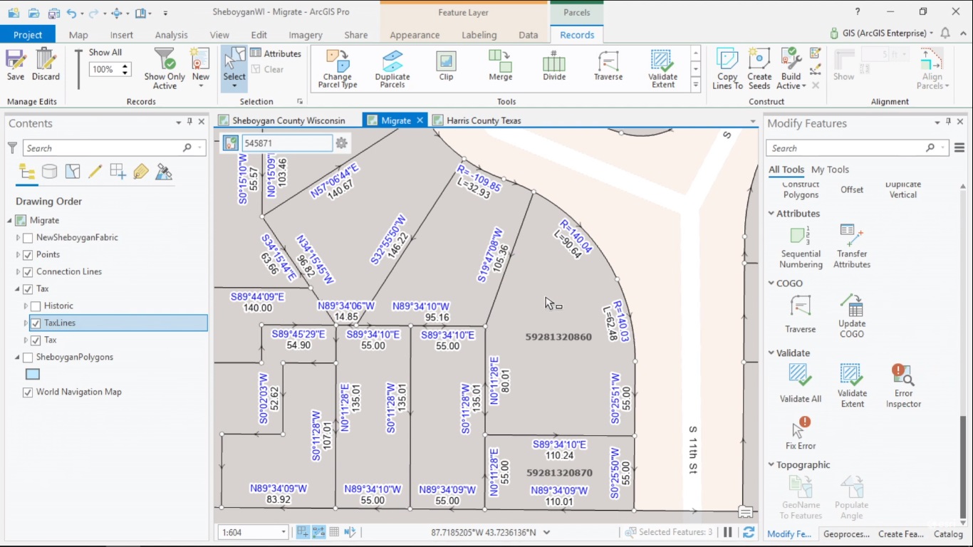
ArcGIS Pro 2.4 now supports the Parcel Fabric framework for managing, editing and sharing parcel data. This article explains what the Parcel Fabric in Pro looks like and how it is different from the one in ArcMap.
How to manage parcel data with ArcGIS
Managing and editing spatial data is the purpose of a GIS. Parcels are spatial features that can be managed together with a GIS so that the spatial relationships between multiple, adjacent parcels can be managed. Just as other types of spatial features, the geometry of parcels can change: for example, they can be split, merged or deleted. Because one parcel often borders various other parcels, changing the geometry of one parcel means that multiple other parcel geometries change as well. ArcGIS Desktop has its own framework for managing, editing and sharing parcel data named Parcel Fabric.
A new Parcel Fabric in ArcGIS Pro
The 2.4 release of ArcGIS Pro now supports the Parcel Fabric framework that was first introduced in ArcMap. The new parcel fabric is different from the old one. You can create a parcel fabric from scratch with Pro or migrate an existing parcel fabric from ArcMap to Pro with the ‘Upgrade ArcMap Parcel Fabric’ geoprocessing tool. In a single-user editing environment, parcel fabric is administered and edited on a file geodatabase. It is also supported in a multi-user environment through ArcGIS Enterprise. Editing on web and mobile clients will be supported in future releases of Pro.
What is a parcel fabric in Pro?
A parcel fabric in Pro is a controller dataset that controls simple feature classes and a geodatabase topology. Parcels are now stored and added as separate parcel types: each time a parcel type is created, a polygon and line feature is added for that parcel type. Now that each parcel type has its own schema, configuration and display of parcel types is easier than before.
Pro’s parcel fabric workflows are record-driven, which means the parcel fabric is edited in response to legal records. Parcel features are associated to the record that created or retired them, which makes it possible to track parcel lineage (although the visualization of this lineage is not yet available in Pro). Pro’s parcel fabric has built-in topology rules and error management that are added to a parcel fabric when it is created. These rules can be extended and configured by the user’s organization because parcel data quality is a subjective matter, to be defined by the creators and users of the data.
Parcel fabric feature classes
A parcel fabric contains multiple feature classes of a single feature dataset, that are displayed in the contents pane in Pro. First, there’s a records feature class, containing the geometry of the records to be displayed. A records feature class matches the geometry of all parcels associated to that record, so that if a parcel feature is deleted, the associated record is updated as well. Actual parcels are stored in a parcel type feature class containing line and polygon features. Connection lines are stored in a separate feature class that shows non-boundary lines in a parcel fabric. A separate feature class for points that shows points and control points. Errors are displayed in the map as error features and can be interactively fixed. A parcel fabric can be added to the map by dragging the controller dataset (recognizable by the blue parcel fabric logo) to the map, which drags all associated feature classes that are with it.
Differences between ArcMap parcel fabric and ArcGIS Pro parcel fabric
There are several differences between ArcMap’s and Pro’s parcel fabric. In ArcMap, all parcel types were stored in one feature class. In Pro, each parcel now has its own schema. ArcMap had a plans table without geometry, while Pro now uses a records feature class with record geometry. In ArcMap, points, control points and line points each had a separate feature class, while Pro uses one feature class for points and control points. There’s no need for line points in Pro as it uses topology and spatial coincidence to maintain connectivity between features. ArcMap used a ‘Check Fabric’ command that created a text file for topological errors, while Pro can validate as-you-go and create error features in the map that can be identified and fixed. Invisible, unjoined, unclosed or construction parcels are deprecated in Pro: these need to be joined before upgrading an existing parcel fabric from ArcMap to Pro.
Upcoming ArcGIS Pro Classes
Learning ArcGIS Pro 1: Maps and Projects
Learning ArcGIS Pro 2: Editing, Analysis, and Automation
Learning ArcGIS Pro 3: Converting, Linking, and Analyzing Data
Learning ArcGIS Pro 4: Sharing Your Maps and Data

