Together with this year’s Esri UC, a set of product updates were announced: ArcGIS Pro 2.4, its product extensions, the Pro .NET SDK and the ArcGIS API for JavaScript.
ArcGIS Pro 2.4
The most important product release for this year’s UC is the latest release of ArcGIS Pro 2.4. Many new features are covered here. During the plenary session of the UC, some of Pro’s new features were demoed, such as Pro support for parcel fabric, a framework for managing, editing, and sharing parcel data.
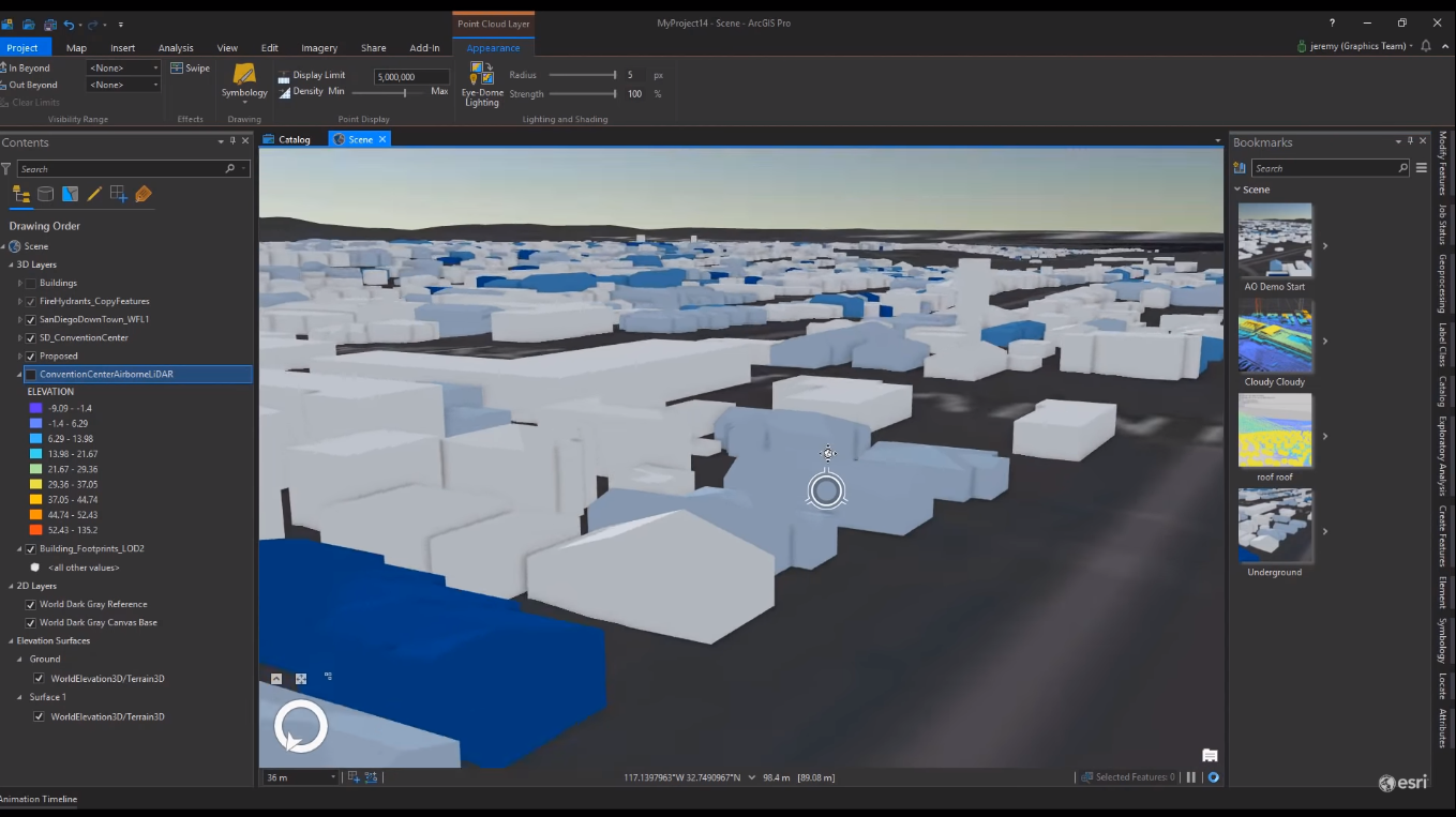
It’s worth noting that Pro 2.4 uses an upgrade of the I3S specification, which is version 1.7. 3D objects and mesh scene layers not only draw faster than before but the objects themselves look better and realistic due to better lighting techniques. New in Pro is eye-dome lighting, a shading technique that improves depth perception when viewing lidar points in 3D. This results in a better understanding of both the shape of the data and the attribution captured in a point cloud.
ArcGIS Pro 2.4 Extension updates
Both the Image Analyst and Spatial Analyst extensions of Pro have seen significant updates for this release. The Spatial Analyst for example has new and updated geoprocessing tools, raster functions and arcpy functions. Pixel editing capabilities have been added to the Image Analyst extension: the Pixel Editor can reclassify thematic data one pixel at a time or a whole region at a time. Additionally, regions of pixels can be replaced to repair artifacts. Elevation can be edited to smooth an area or even remove terrain. With the volume tool in the mensuration gallery, the volume of objects in a DSM or DTM can now be measured.
ArcGIS Pro 2.4 SDK for .NET
In addition to a new version of ArcGIS Pro, a new Pro SDK was released. Here are some of the highlights of the new release:
- Support for Visual Studio 2019:
- A new Scene Layer API that enables access to each of the different scene layer types, as well as updating with filters or filter blocks, queries, selections and symbology;
- A new real-time Stream Layers API for performing searches and selections using stream layers, these are Pro feature layers with a stream service;
- Support for CIM enhancements. CIM a map content specification used to persist and transfer cartographic descriptions of GIS datasets and is persisted as JSON;
- Support for ArcGIS Pro Extensions NuGet, that offers an alternative way to reference the ArcGIS Pro assemblies.
ArcGIS JavaScript API 4.12 release
The latest release of the ArcGIS API for JavaScript is version 4.12. Also new is its accompanying website with code examples, tutorials and documentation. New features of the JavaScript API include:
- Performance increases throughout various aspects of the API, such as faster loading of vector tile layers;
- A new time slider widget for visualizing temporal data;
- Over 100 new 2D vector data symbols;
- Animated water rendering for more realistic 3D scenes;
- New 3D line symbols, using square, strips and wall styles;
- Added support for filters on BuildingSceneLayers;
- Perform client-side queries with scene layers and feature layers in 3D scene views;
- Smart mapping capabilities as a result of reaching parity with the 3.x API’s smart mapping capabilities;
- New slider widgets for exploring data with color, size or opacity;
- Overall modernization of the API, reducing the size of the API which improves load performance.
Upcoming ArcGIS Pro Classes
Learning ArcGIS Pro 1: Maps and Projects
Learning ArcGIS Pro 2: Editing, Analysis, and Automation
Learning ArcGIS Pro 3: Converting, Linking, and Analyzing Data
Learning ArcGIS Pro 4: Sharing Your Maps and Data

