
Esri recently released a new visualization style and supporting basemap for ArcGIS Pro that you’re going to want to check out. The new Firefly style and supporting basemap can be used to create really attractive thematic visualizations. In this article I’ll show you how to put these to use in your ArcGIS Pro projects.
Examples
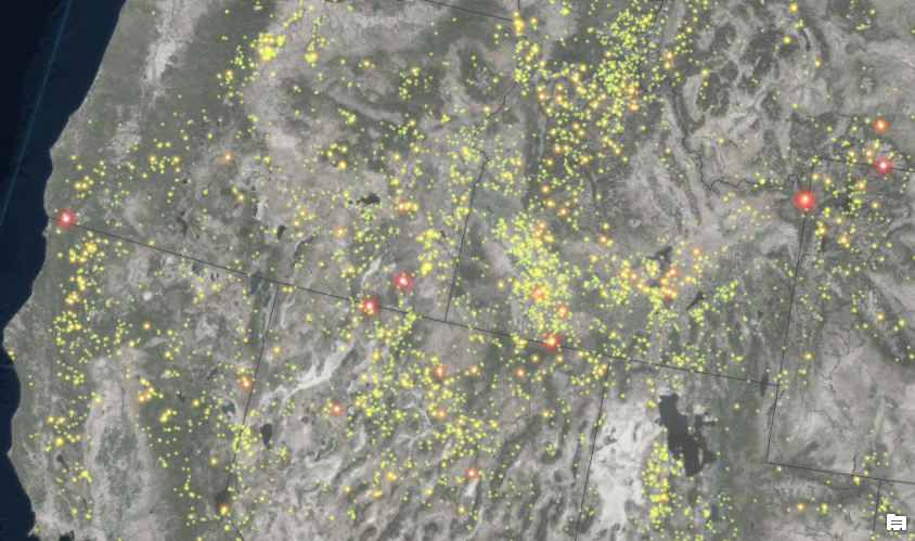
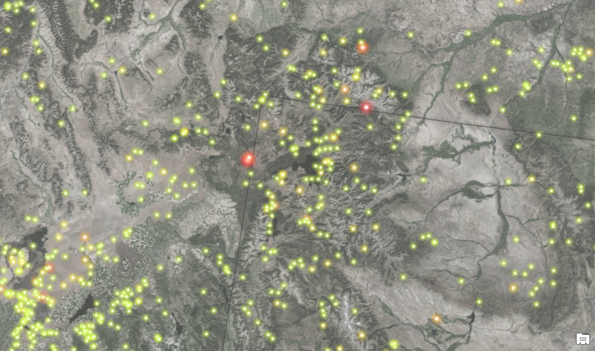
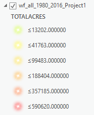
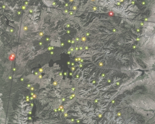
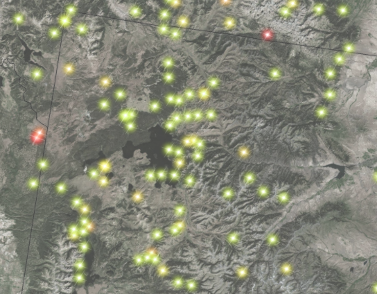
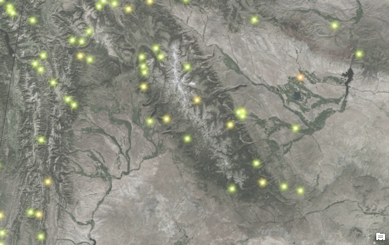
Let’s start with a few examples. The screenshots below depict large wildfires (greater than 1,000 acres) in the western United States from 1980 – 2016 using the Firefly style for points. In addition to applying the Firefly style I have also graduated the symbol size based on the total acreage burned by each wildfire. The Firefly style can also be used for lines and polygons.
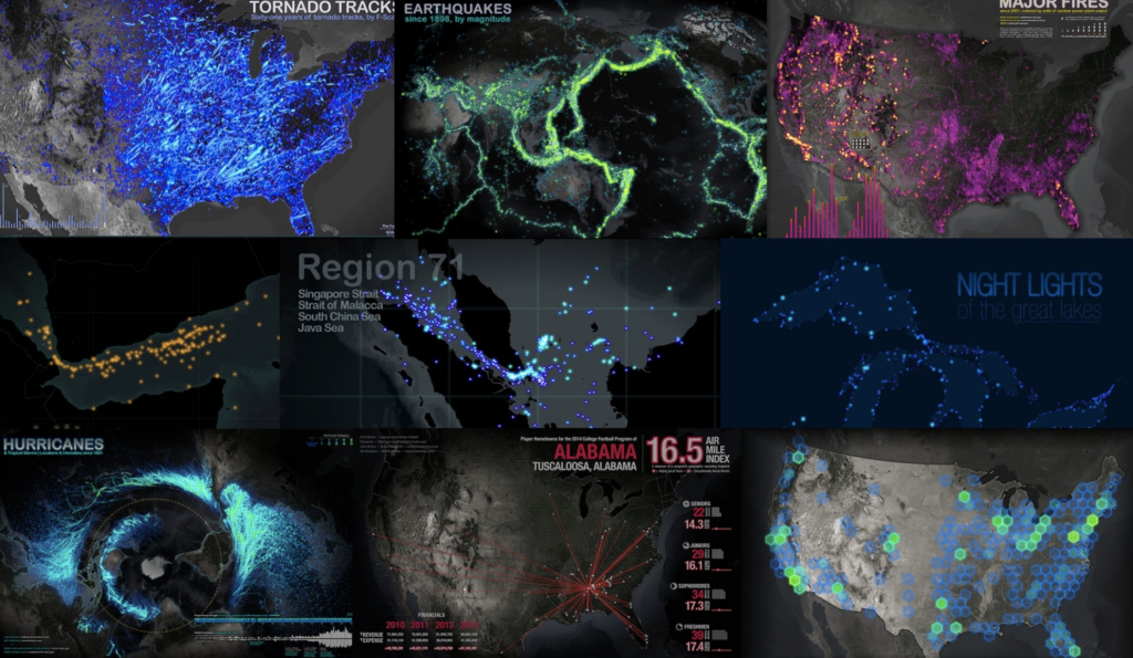
Here are some additional examples that display tornadoes, earthquakes, hurricanes, fires, and a few other datasets.
Downloading the Style
Before you can use the Firefly style in an ArcGIS Pro project you’ll need to download and load the Firefly.stylx file.
Link to download Firefly.stylx.
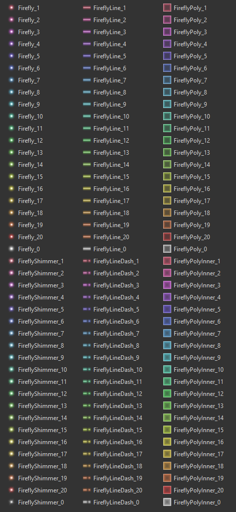
The Firefly.stylx includes the following points, line, and polygon symbols. This includes 20 pre-defined colors for each symbol.
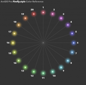
The color reference for these styles is as shown below.
The symbols come in standard and shimmer style, both of which are illustrated in the screenshots below.
Standard
Shimmer
Loading the Style in ArcGIS Pro
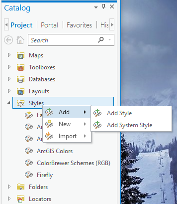
Follow the steps provided below to load the Firefly.stylx file into an ArcGIS Pro project.
- Open ArcGIS Pro and load a project.
- Go to the Catalog pane
- Find the Styles item
- Right click Styles and select Add | Add Style as shown in the screenshot below. This style will now be added to the current ArcGIS Pro project.
Using the Firefly Style
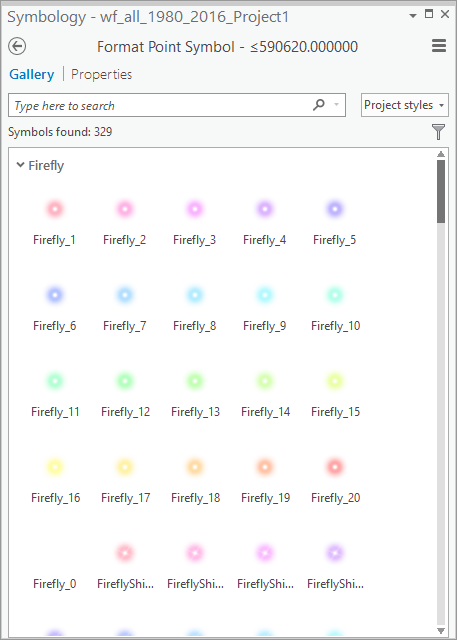
The Firefly style should now be available to you through the Symbology Pane in the Gallery tab shown below. The Symbology Pane is accessed by double clicking a symbol for a layer in the Contents pane.
The Basemap is Important!
The basemap that you use when applying the Firefly style is just as important as the style. In general, the basemap should be as dark as possible and mostly devoid of color. This allows for a significant contrast between the style and the basemap. To that end, Esri has created a basemap specifically for the Firefly style. This basemap is called World Imagery (Firefly), and can be accessed via URL at https://fly.maptiles.arcgis.com/arcgis/rest/services/World_Imagery_Firefly/MapServer. You can see an example of this basemap in the screenshot below.
This layer presents an alternative view of the World Imagery map designed to be used as a neutral imagery basemap, with de-saturated colors, that is useful for overlaying other brightly styled layers. The Dark Gray Canvas basemap also works well with the Firefly style.
Additional Resources for Firefly
Firefly Basemap Starter Pack for ArcGIS Pro
Steal this Firefly Please – Blog Post
World Imagery (Firefly) Basemap
Upcoming ArcGIS Pro Classes
Learning ArcGIS Pro 1: Maps and Projects
Learning ArcGIS Pro 2: Editing, Analysis, and Automation
Learning ArcGIS Pro 3: Converting, Linking, and Analyzing Data
Learning ArcGIS Pro 4: Sharing Your Maps and Data
Introduction to Programming ArcGIS Pro with Python
Intermediate ArcGIS Pro Programming with Python
