
Display filters in ArcGIS Pro are queries that limit which features of a layer are displayed. Display filters can be determined by scale, or set manually. They differ from definition queries in that display filters impact the display only. The features filtered from the display by display filters are still available for query and analysis. Features filtered by definition queries are not available to the layer at all. Use display filters when you want to draw a subset of features, but you want to retain access to all features. When a display filter is active, all features in the layer remain in the layer’s attribute table and can be selected, identified, edited, and be available for geoprocessing operations. But, because only visible features are labeled, display filters affect the labeling of a layer.
Want to learn more about ArcGIS Pro? Take a look at our Online Training Bundles and Live Online Training events.
Two Types of Display Filter
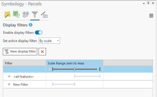
Each layer can have multiple display filters, but only one can be active at a given point in time. There are two types of display filters: Scale and Manual. Scale display filters are associated with a visible scale range. It is possible to have multiple scale display filters, but the ranges are mutually exclusive and continuous. There can be no gaps or overlaps in the scales. Manual display filters are defined by query only. There is no associated scale range.
Enabling Display Filters
Starting with ArcGIS Pro 2.6 the Symbology pane includes a Display filters button that you can use to enable and define filters.
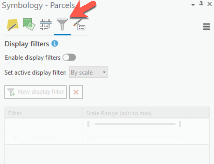
Display filters for a layer must be enabled before they can be used. To do so, click the Display Filters button on the Symbology pane and then click the “Enable display filters” toggle button to enable the display filters functionality.
Scale Based Display Filters
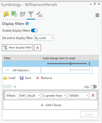
To add a scale based display filter set the “Set active display filter: to “By scale”. Then, use the thumbs to define a scale range as well as an optional expression. In the example below, which is applied to a parcel layer, the display filter will display features whose market value is greater than $500,000 when the map scale is less than 1:50,000. If you’d like to add multiple display filters click the “New display filter” button and repeat this process.
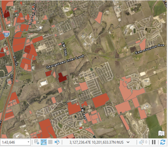
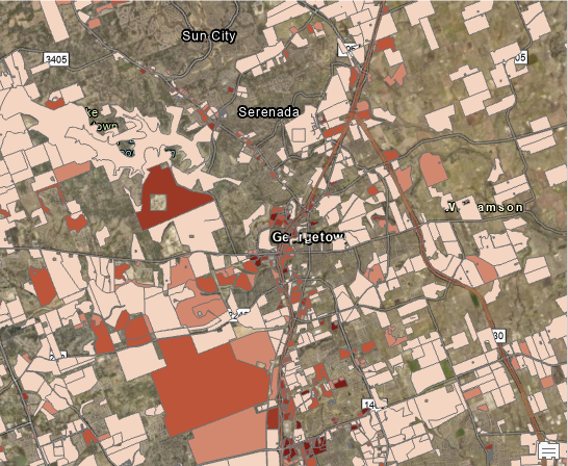
The result of this scale based display is displayed in the screenshot below. The scale is below 1:50,000 and only parcels with a market value of greater than or equal to $500,000 are displayed.
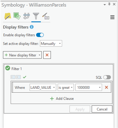
Manual Display Filters
Manual display filters are composed only of an expression. Set the type to “Manually” and then use the expression builder to define the expression. The example below sets a manual filter to display parcels with a land value of greater than or equal to 1,000,000.
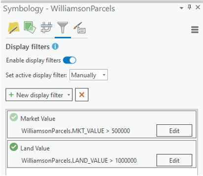
It is possible to create multiple display filters, but only one filter can be active at a time. Filters can also be assigned names other than the default. By default, display filters will be assigned names like Filter1, Filter2, etc. If you double-click on the name you can type in a new name. The green check marks indicate which filter is currently active. A dark green check mark indicates the active filters while a light green (greened out) check mark is an inactive filter. In the screenshot below, the Market Value filter is active in the screenshot on the top, while the Land Value filter is active on the bottom screenshot.

Want to learn more about ArcGIS Pro? Take a look at our Online Training Bundles and Live Online Training events.
