
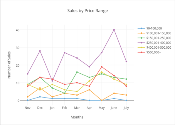
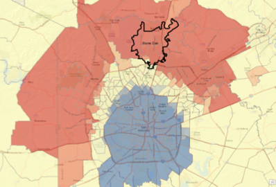
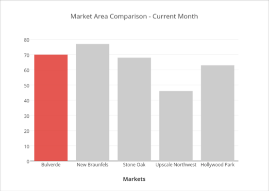
Geospatial Training Services implemented a geoprocessing workflow for a local real estate company that processes monthly residential home sales information on a monthly basis and creates over 2000 reports on individual neighborhoods in the San Antonio metropolitan area. Each report contains tables, graphs, charts, and interactive maps.
The workflow uses ArcGIS Desktop including the Spatial Statistics Toolbox, Python with ArcPy, Plotly, and Carto to create the reports. The entire process is automated with Python scripts that are scheduled to run at specific times of the month. Screenshots of the output products are provided below.
Contact Geospatial Training Services to schedule a time to discuss your geoprocessing automation and application development needs.
Technologies Used:
- ArcGIS Desktop
- ArcGIS Desktop Spatial Statistics Toolbox
- Python with ArcPy
- Carto
- Plotly
- Geocodio
- Geodatabase
Screenshots:

Contact Geospatial Training Services to schedule a time to discuss your application development needs.
