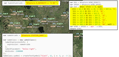
Geospatial Training Services is releasing a new Getting Started with ArcGIS Arcade on Friday, April 28th.
Arcade is a response to a common problem. How do you display data when there is no column in the schema containing that data? Up until now, if the map layer you are working with did not have exactly the right attribute data you need, you had two choices: alter the underlying data or bring in the services of an application developer.
ArcGIS Arcade is an expression language with a simple scripting syntax that enables you to manipulate your existing data to generate new information based on it. While this sort of functionality has always been available in certain Esri products – most notably ArcGIS Desktop – the aim behind Arcade is to make it available everywhere in the ArcGIS platform, and for it to work identically in all environments.
You can almost think of Arcade as “Excel for ArcGIS”. In much the same way as Excel lets you write formula to work with spreadsheet data, Arcade lets you do the same with map data. In the initial release of Arcade, you can create and reference geometries. In future releases, other geometry functions may be added allowing you to calculate areas and lengths, and perform simple overlay operations in more complex expressions.
Course Modules:
- Module 1: Introduction to ArcGIS Arcade
- Module 2: Writing Your First Expression
- Module 3: The Arcade Expression Language: Structure
- Module 4: The Arcade Expression Language: Data Types
- Module 5: The Arcade Expression Language: Functions
- Module 6: The Arcade Visualization Profile
- Module 7: The Arcade Labeling Profile
- Module 8: Conclusion
This course will be offered in various formats including self-paced, live-online, and classroom. Click here for more information.

