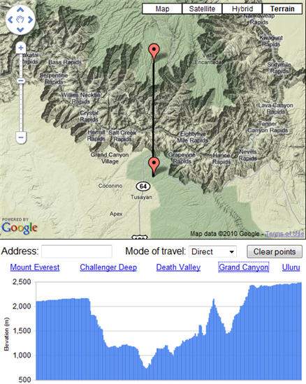
The Google Maps team continues to add really useful functionality to the Maps API. Now the Google Maps API team has introduced a new Elevation Service that enables applications to determine elevation profiles. The Maps API v3 contains an ElevationService class or you can simply use the Elevation Web Service as an HTTP request from v2 applications. You can request the elevation in meters for one or more sets of coordinates, or you can request a specific number of elevation samples spaced along a path.
The figure below shows a sample application that uses the Google Visualization API to plot elevation profiles. You can add additional points by clicking on the map or entering an address, and you can switch between different modes of travel to see the affect on the profile. If you roll your mouse over the profile chart you can see on the map the point that the given sample relates to
I’ll have some code examples on this new service soon.

