
AI, ArcGIS Online Courses
Building GIS Web Applications with AI for Beginners
12 GISP Credit Hours
This course targets GIS professionals who want to build and publish a working web map but have no background in web development. If you have never written HTML, CSS or JavaScript, you are the person this was written for.
It is equally aimed at GIS staff who have started using an AI assistant and found that it produces code they cannot evaluate. The course spends as much time on checking and fixing what the AI gives you as it does on asking for it.
No programming experience is required. No previous experience with AI tools is required.
Everything this course uses is free, and there is nothing to buy before you enroll.
- Visual Studio Code with the Live Server extension — both free, installed in about ten minutes
- Microsoft Edge or Google Chrome — whichever you already have
- An AI assistant account — Claude, ChatGPT, Copilot or Gemini. Examples use Claude; any of them will do.
- Optional – A GitHub account — free, and only if you choose the publishing route that needs one
No ArcGIS Pro license is required. One exercise is better if you can sign in to ArcGIS Online and look at one of your own layers, but a public layer is supplied for anyone who cannot.
There is no build system, no framework, and nothing to install from a command line.
Ten instructional modules, each with its own hands-on exercise:
- Module 1: What AI Means for GIS Professionals
- Module 2: Getting Comfortable with AI Tools
- Module 3: Web Development Concepts for GIS Users
- Module 4: Understanding Web GIS Data Sources
- Module 5: Writing a GIS App Prompt
- Module 6: Building Your First AI-Assisted Web Map
- Module 7: Making the Map More Useful
- Module 8: Fixing Common Problems
- Module 9: Performance and Simplification
- Module 10: Publishing and Sharing
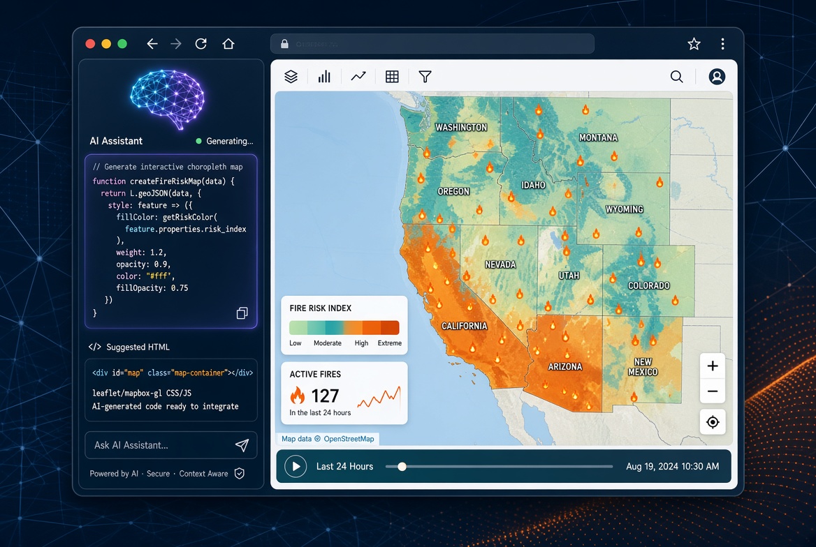
This 1.5-day program takes you from no web development experience to a published, working web map, using an AI assistant as the drafting tool and your own GIS judgment as the check on it.
You build one real application across the course: a wildfire activity viewer drawing live incident data from the National Interagency Fire Center, with states shaded by acres burned, hover and click detail, and a live incident layer. You build it in stages, testing after every one, so that when something breaks you know which change broke it.
The second half is what separates this from a prompting course. Module 8 puts three deliberately broken maps in front of you and has you diagnose them from the browser console — including one that reports no error at all, because a clean console does not mean nothing is wrong. Module 9 has you measure your page against a deliberately wasteful version on a throttled connection, and make one change that you can prove worked. Module 10 publishes it and reviews it the way a member of the public would see it.
There are ten exercises totalling close to seven hours of hands-on work, including a three-hour guided build. Every exercise is written step by step, with the exact words to paste, what you should see when it worked, and what to check when it did not.
You finish with a working application, a published URL, and a method you can use on the next one.
Don’t want to purchase online? You can also register for classes using our registration form.
This course made it less intimidating to switch from ArcMap to ArcGIS Pro. So glad I attended.
Student, Idaho State Tax Commission
Knowledgeable instructor, well paced class, applicable information covered, hands-on style.
Brandon Clark, Alabama Power
I strongly and highly recommend it
Matt Gubitosa, U.S. EPA
I really enjoyed the Python/ArcGIS course. For me the right balance between detail and overview. Good work!
Pal Herman Sund
I thought the course was very organized. The style of presentation and the lesson format worked well together. It made the information easy to understand. -
Kyle Lockhart, Escambia County, FL
Class was well organized, well paced and I learned a lot.
Aleeta Zeller, Chattanooga RPA
Definitely got me "over the hump" of being able to grasp Python.
Joseph Monti
These courses are great. I am so pressed for time this is the only way I can acquire extra skills these days. Thank you Eric for all your hard work!
Chris Hickin, NYC Fire Dept.
I have attended a number of instructor-led training courses offered by ESRI, which are great in their own right, but the Mastering the ArcGIS Server JavaScript API course gets much more in-depth than they often do. I really liked the recommended reading, they helped expand the terms being covered in lecture to concrete examples that could be related back to my work more directly instead of just having the lecture and exercises alone. I learned a lot andwill recommend this and other GeoSpatial Training courses to the GIS'ers I know. Thanks for putting this course together and offering it.
Jason Warzinik, Boone County, MO
Really good course material. Very relevant subject matter.
Michael Philp, City of Springville, UT
Very informative and knowledgeable course. It help determine which direction I should take my further GIS and web programming skills.
Chris Pollard, Delaware Valley Regional Planning Commission