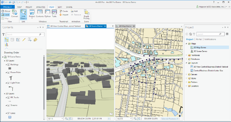
Esri is set to release version 2.0 of ArcGIS Pro at the end of this month. For those that might not know, ArcGIS Pro is Esri’s newest desktop GIS application which will ultimately be replacing ArcMap, ArcCatalog, ArcScene and ArcGlobe. ArcGIS Pro is built on a 64 bit architecture which allows it to make use of all the hardware you can throw at it and has a completely new modern ribbon interface.
When will this replacement happen? That is a good question. Sadly, I don’t have an exact answer. It seems to depend on who you talk to at Esri. I have heard anything from 2 to 7 years. You can see the transition is already starting by going to Esri’s product page on their website. You will see that it lists ArcGIS Pro as their lead desktop platform. You have to dig a bit to find any mention of ArcMap or ArcCatalog.
What I do know is that Esri is putting almost all their desktop development efforts into ArcGIS Pro. So, don’t expect any new functionality of any significance to be added to the traditional ArcGIS Desktop platform.
What’s coming in ArcGIS Pro 2.0
What can you expect to see in this new version of ArcGIS Pro? Esri continues to push toward parity with ArcMap. The current version, 1.4, went a long way in this regard. It added a lot of functionality so that if you primarily use ArcMap to create maps, perform simple GIS analysis or edit data using basic tools or even topologies, you may be able to switch to ArcGIS Pro now.
ArcGIS Pro 2.0 will continue this tread of adding even more functionality. Here are some capabilities and changes which will be included in ArcGIS Pro 2.0
- Support for Annotation
- Allows multiple Instances of ArcGIS Pro to be running at the same time on the same computer
- The Project Pane will be renamed to the Catalog Pane
- Will remember folder and database connections between projects
- Adds grids for layouts
- Charts will be supported in Layouts. These will be dynamic charts that update as your data changes
These are some pretty big improvements.
What might be coming in ArcGIS Pro 2.1
Of course, Esri is already planning for the next version. So, what might be included in the version that follows 2.0? Here are a few things we believe will be included:
- Construct Polygon tool from ArcMap Advanced Editing Toolbar
- Copy Parallel Editing tool
- Geometric Network which will be renamed Utility Network
- Reports
- Support for Representations
- Spatial Adjustments
For more information about what you might see in ArcGIS Pro 2.0 or later versions click on the links below:
Here are some links to a couple free recorded webinars I have done on ArcGIS Pro which you might also find useful:
If you have not already been looking at ArcGIS Pro and evaluating it, now is the time. As we mentioned, it will be replacing ArcMap and ArcCatalog. It is time to start planning your migration since it is not a matter if but when you will need to do so.
Want to learn more about ArGIS Pro? Check out our upcoming schedule of ArcGIS Pro classes.
Learning ArcGIS Pro: Fundamentals
July 31st and August 1st – Portland, OR
August 14th and 15th – Denver, CO
August 28th and 29th – San Antonio, TX
September 25th and 26th – Atlanta, GA
October 26th and 27th – Phoenix, AZ
Introduction to Programming ArcGIS Pro with Python
August 2nd and 3rd – Portland, OR
August 16th and 17th – Denver, CO

