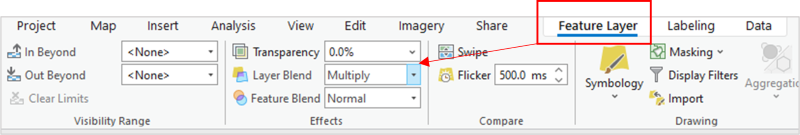
Do you feel like you spend too much time on reordering and adjusting transparency of layers just to show overlapping features, such as hillshade? If this issue is still haunting you, then you must not have moved on to ArcGIS Pro or the new Map Viewer, yet, where you can enable various blend modes to quickly achieve your visual ambitions.
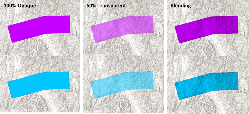
Though Layer Blending is new to GIS software, it has been available for decades in graphics editing software such as Photoshop and Adobe Illustrator. Simply put, layer blending refers to how overlapping layers interact with one another. In more specific terms, blending modes are mathematical equations that blend layers based on the pixel values which define hue, saturation, and luminosity. Different blending modes use different algorithms to characterize how the pixels will blend.
How do I start blending?
There are more than 30 blend modes available in Map Viewer, over 21 blend modes in ArcGIS Pro and zero blend modes in either ArcMap or Map Viewer Classic. So, if you want to blend and haven’t made the transition to ArcGIS Pro or Map Viewer, yet, then that will be your first step.
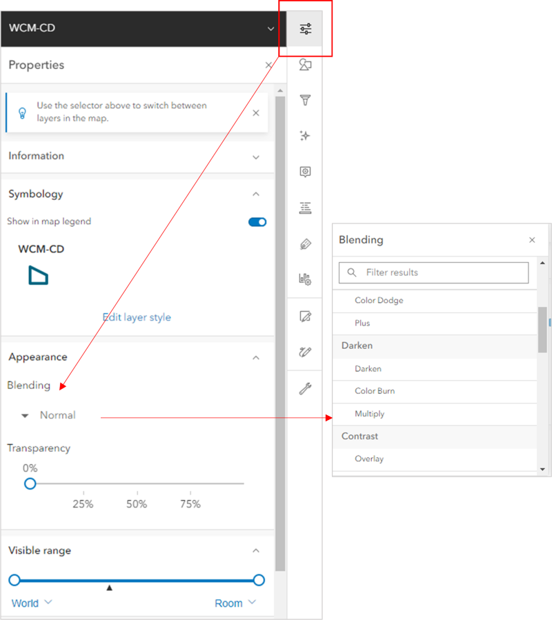
If you are already creating in Map Viewer and ArcGIS Pro, then you are ahead of the game! In ArcGIS Pro, you will find the blend modes in the Feature Layer tab in the Effects settings.
You will see options for Layer Blend and Feature Blend. Layer Blend is the option you will use most often. Feature blending is used when you want to blend features from within the same layer, which is something you might want to do if there are many features in a single layer and you want to pull through some of those overlapping relationships.
In Map Viewer, you will find your blending options in the Appearance settings of your layer properties pane. You simply click the drop-down and scroll through your blend-mode options. I recommend taking some time to click through each mode in Map Viewer so that you will better understand the result.
Which Blend Mode is the best Blend Mode?
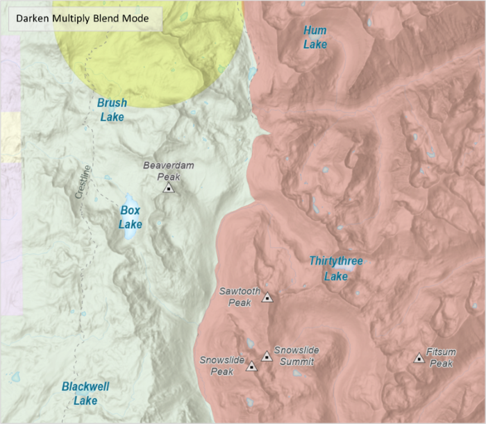
The blend mode you choose will be based on what you need to show in your map, and how you need to show it. I personally use the Darken-Multiply blend mode more frequently than any other mode. Keep in mind that there will still be situations when you will want to combine the use of transparency with Multiply due to its nature of darkening your layers. Nonetheless, it is by far the most useful mode I have found, especially when working with hillshade layers. The expert graphics you can create in a short period of time far exceed any of those that were possible in ArcMap or Map View Classic in the same amount of time. Give it a try! After you blend once, you’ll never go back.
Where can I get my free Guide to ArcGIS Pro Layer Blend Modes?
It’s easy, just click the image below to download it!