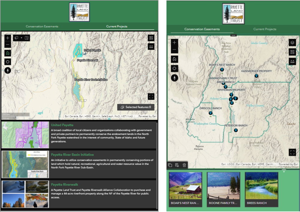
Configure Experience Builder Mobile Views: Tips and Tricks
For the success and credibility of your map applications, it is important to provide users with a single URL. This universal URL should take a user to your application and provide them with an ideal layout regardless of their screen’s size. Today’s...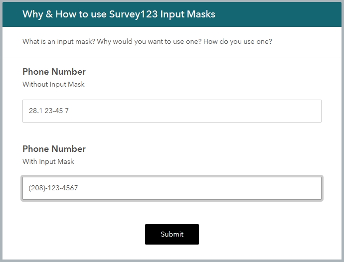
Why you should use Survey123 Input Masks
Survey123 is a magical application that allows you to create input forms that can be used on the web or from mobile devices. They can be used online, or offline. These survey forms can focus on community input, asset inventories, stakeholder feedback, and more. So,...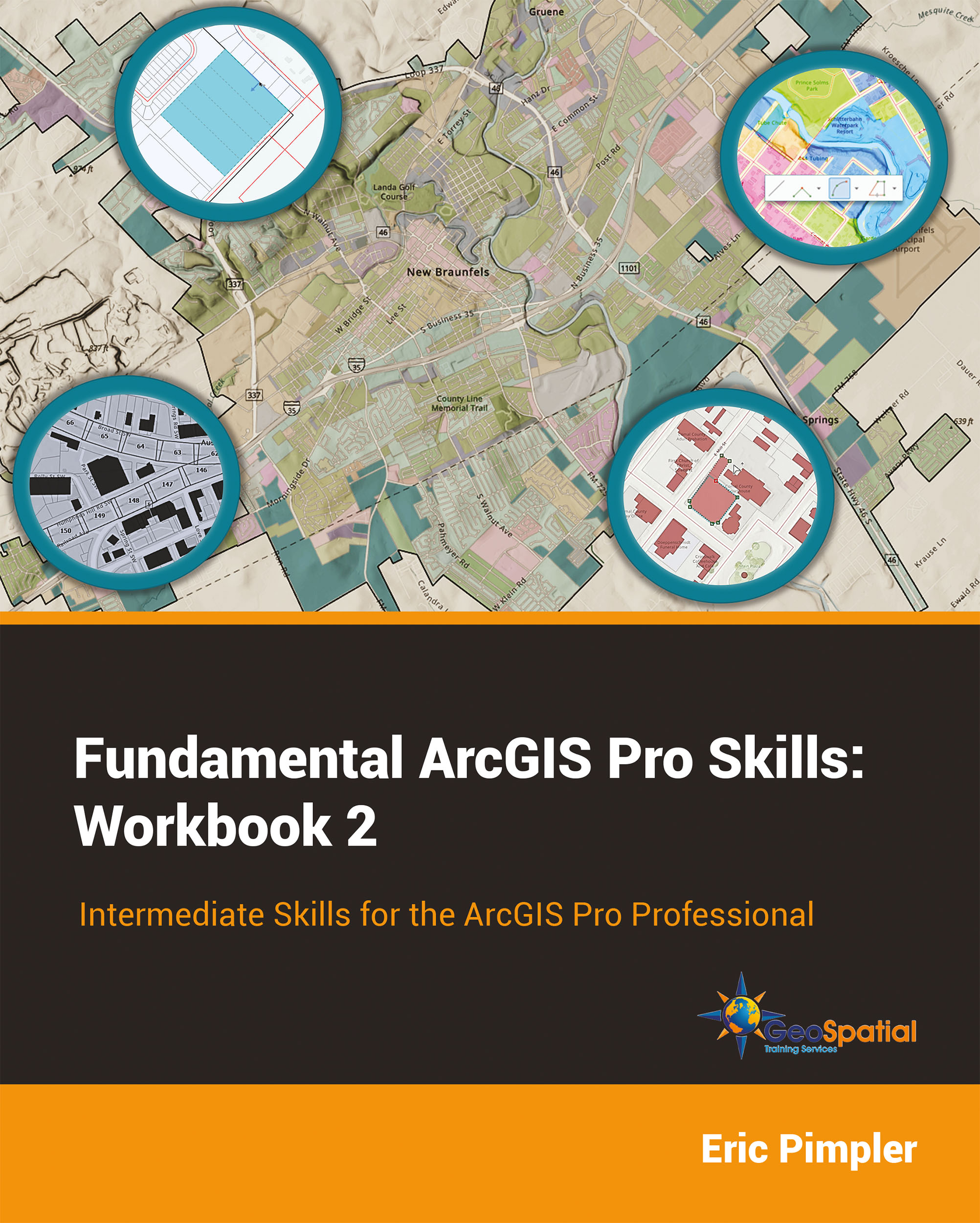
Our New Book – Fundamental ArcGIS Pro Skills: Workbook 2
Our new Fundamental ArcGIS Pro Skills: Workbook 2 has been published! The intermediate level book is the follow up to Fundamental ArcGIS Pro Skills: Workbook 1. If you’re ready to learn intermediate ArcGIS Pro including creating spatial and bookmark map series,...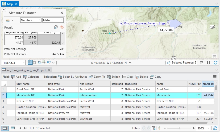
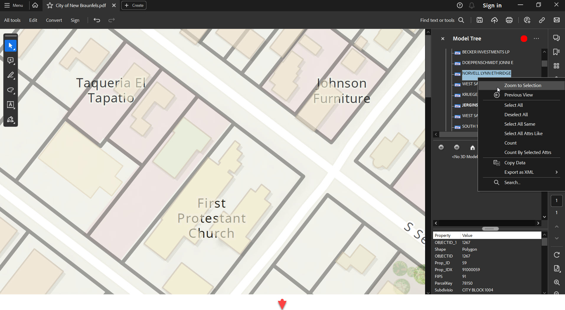
How to Calculate Distances Between Features in ArcGIS Pro
The Near geoprocessing tool in ArcGIS Pro calculates distances between features in different layers. We’ll demonstrate how this tool works using a point and polygon layer. To calculate the distance between two features you could use the measure tool that is available...